
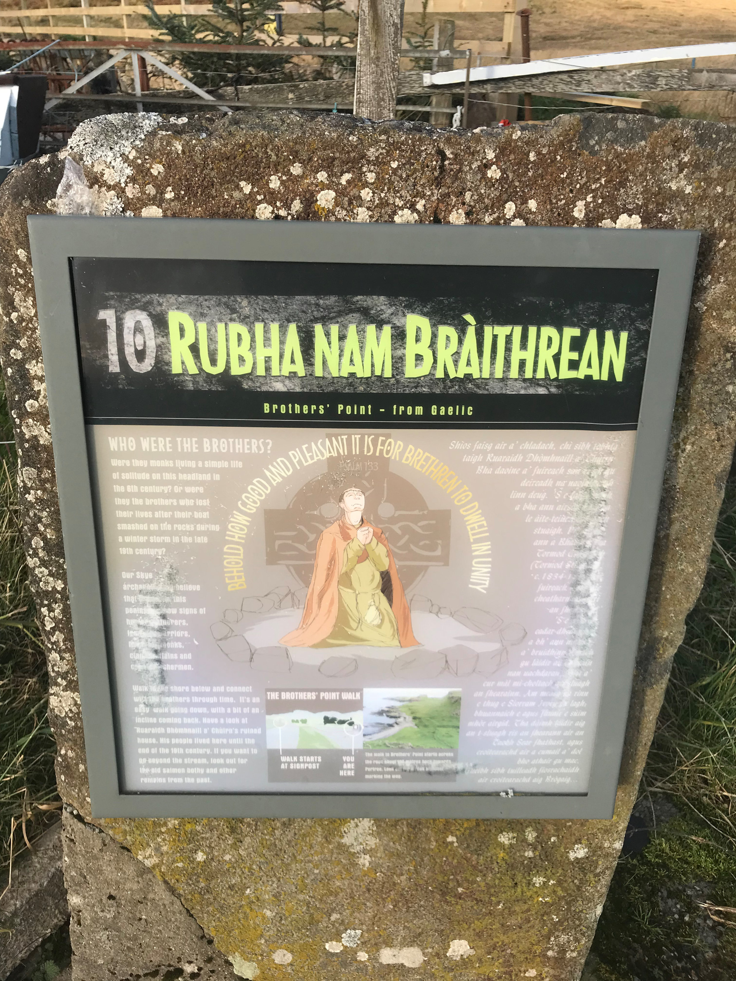
Short Hikes on the Isle of Skye #3 – Rubha nam Brathairean (Brothers’ Point)
The hike to Brother’s Point is not very well known, which makes it a great hike for anyone looking to escape the crowds while exploring the Isle of Skye. However, that may not last for too much longer as earlier this year dinosaur footprints were discovered on the peninsula! We were not able to see them, as we did the hike during high tide, but the views were so great we didn’t mind!

Of our three short hikes on Skye, this one was the easiest. It was also the least marked pathway, but overall it was easy to find our way. Parking for the hike was very limited and easy to miss. The best way to find the small 2-4 vehicle carpark is to look up the Skye Pie Café or The Glenview. On the map you will see a small car park on the side of the road just north of this Inn/restaurant. Also, if you are visiting during the high tourist season, we’ve heard the Skype Pie Café is amazing! Unfortunately for us, it was closed for the season when we visited.
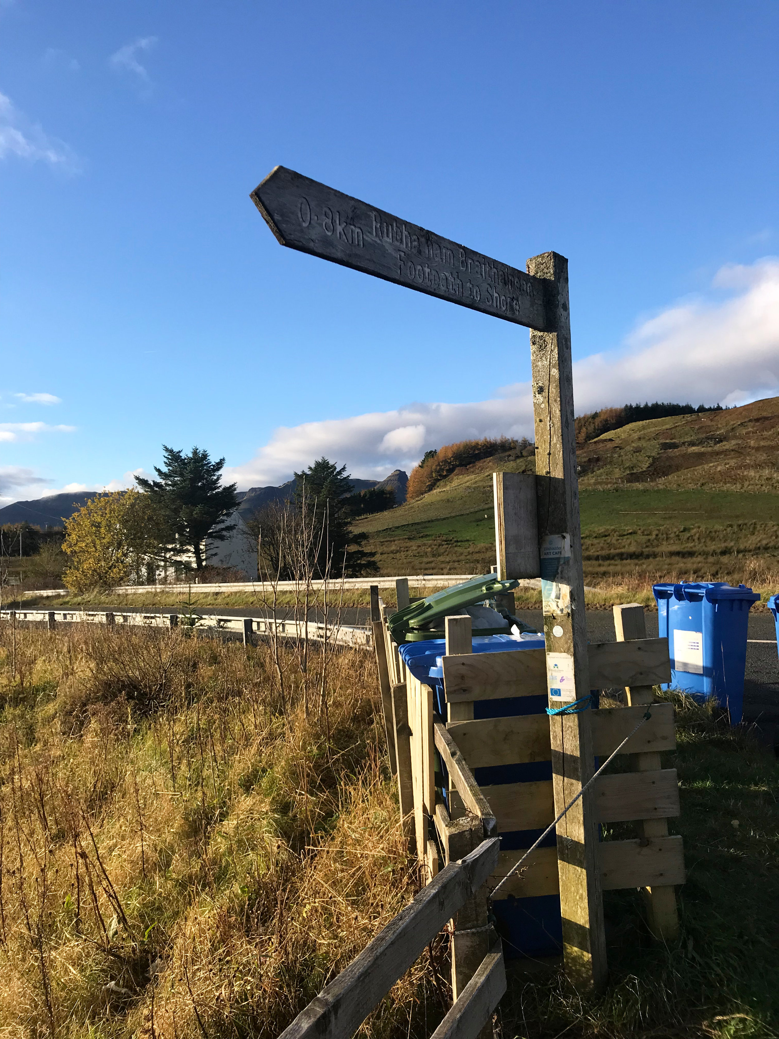
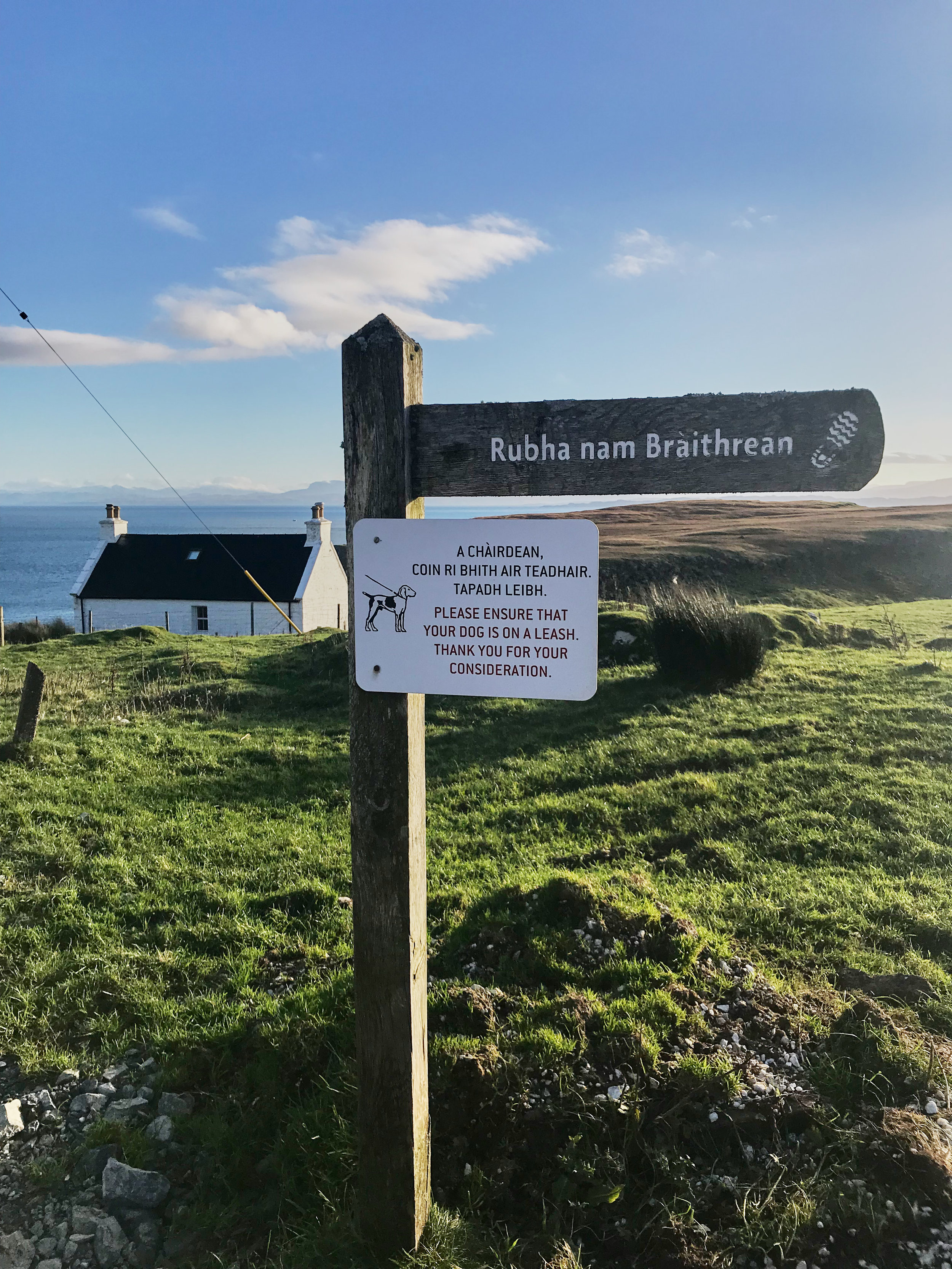
At this small car park you will see a sign for the Rubha nam Brathairean (Brothers’ Point) hike, so you know you are on the right track. The start of the hike is across the street, where you see a wooden footpath sign that says “Rubh' nam Braithrean”. It is hard to read, but here is a picture of what it looks like.
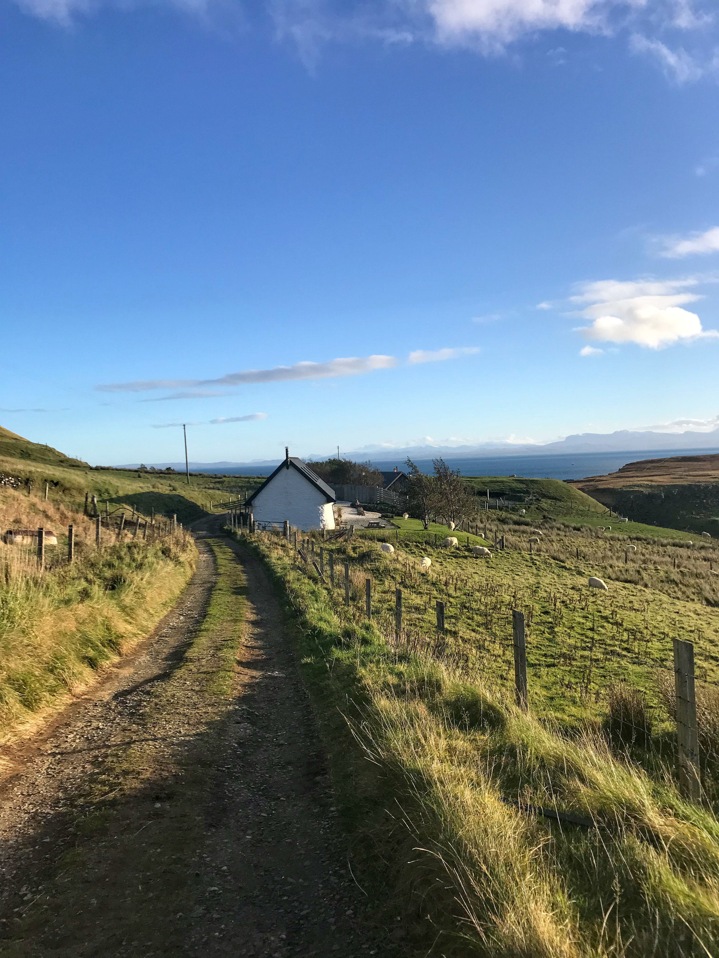
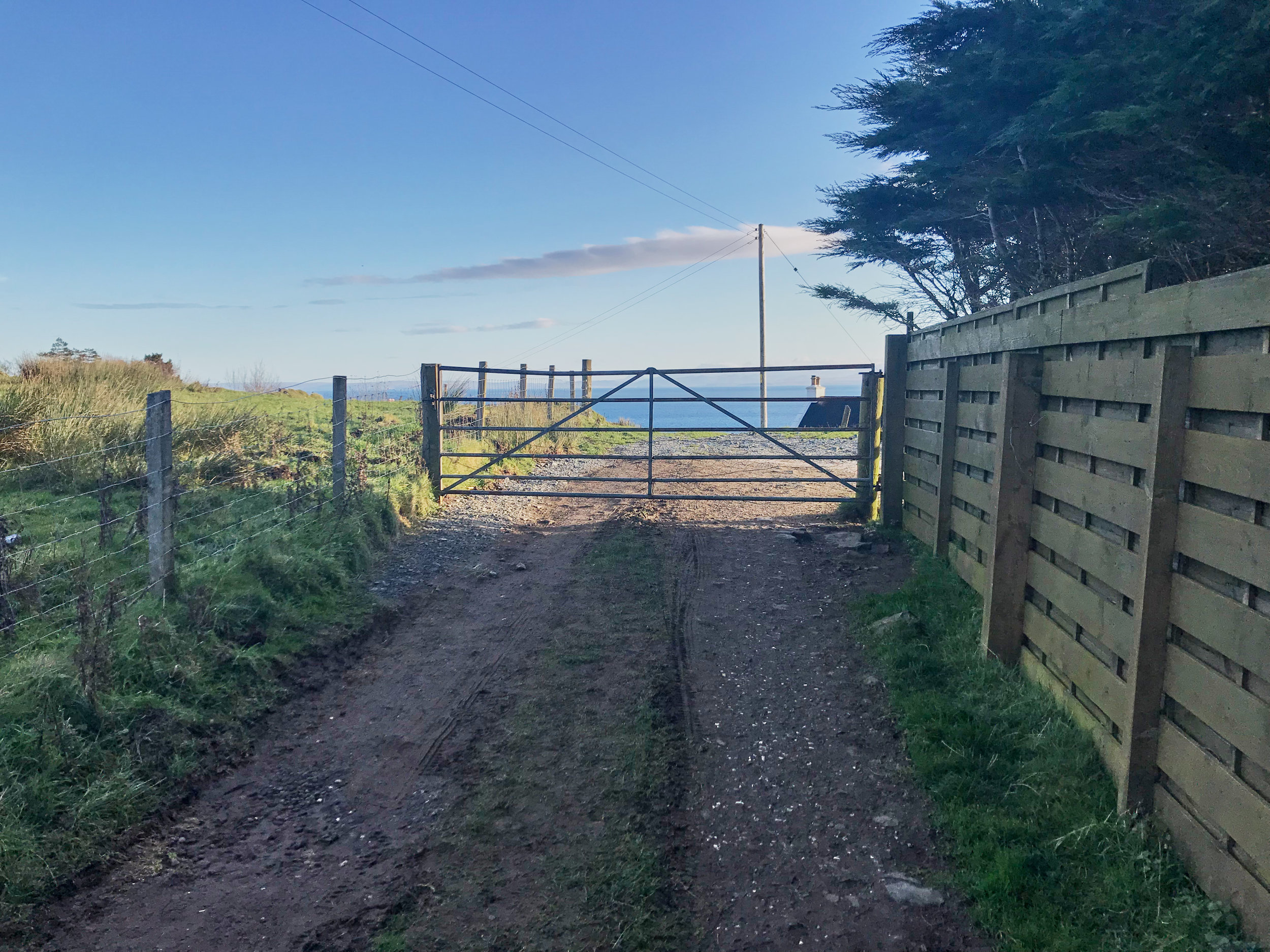
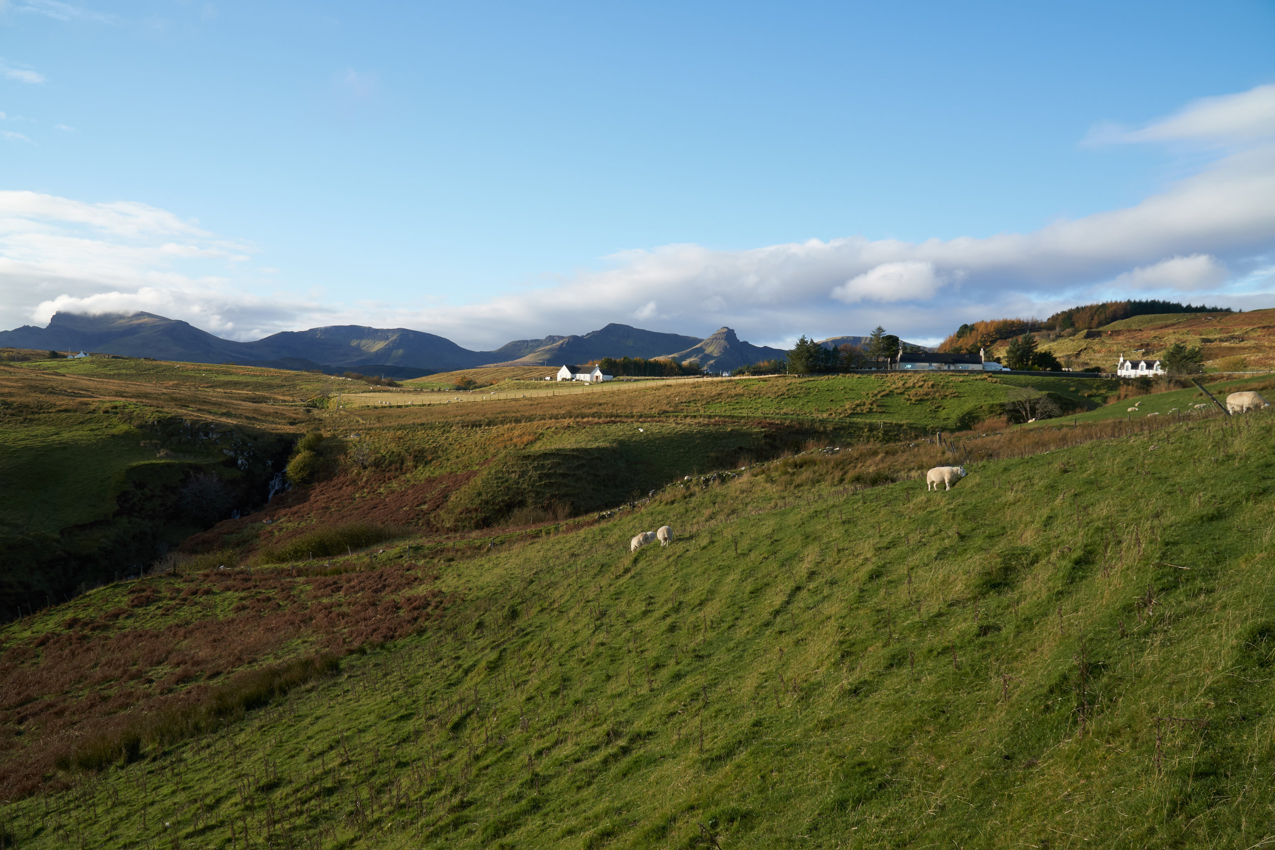
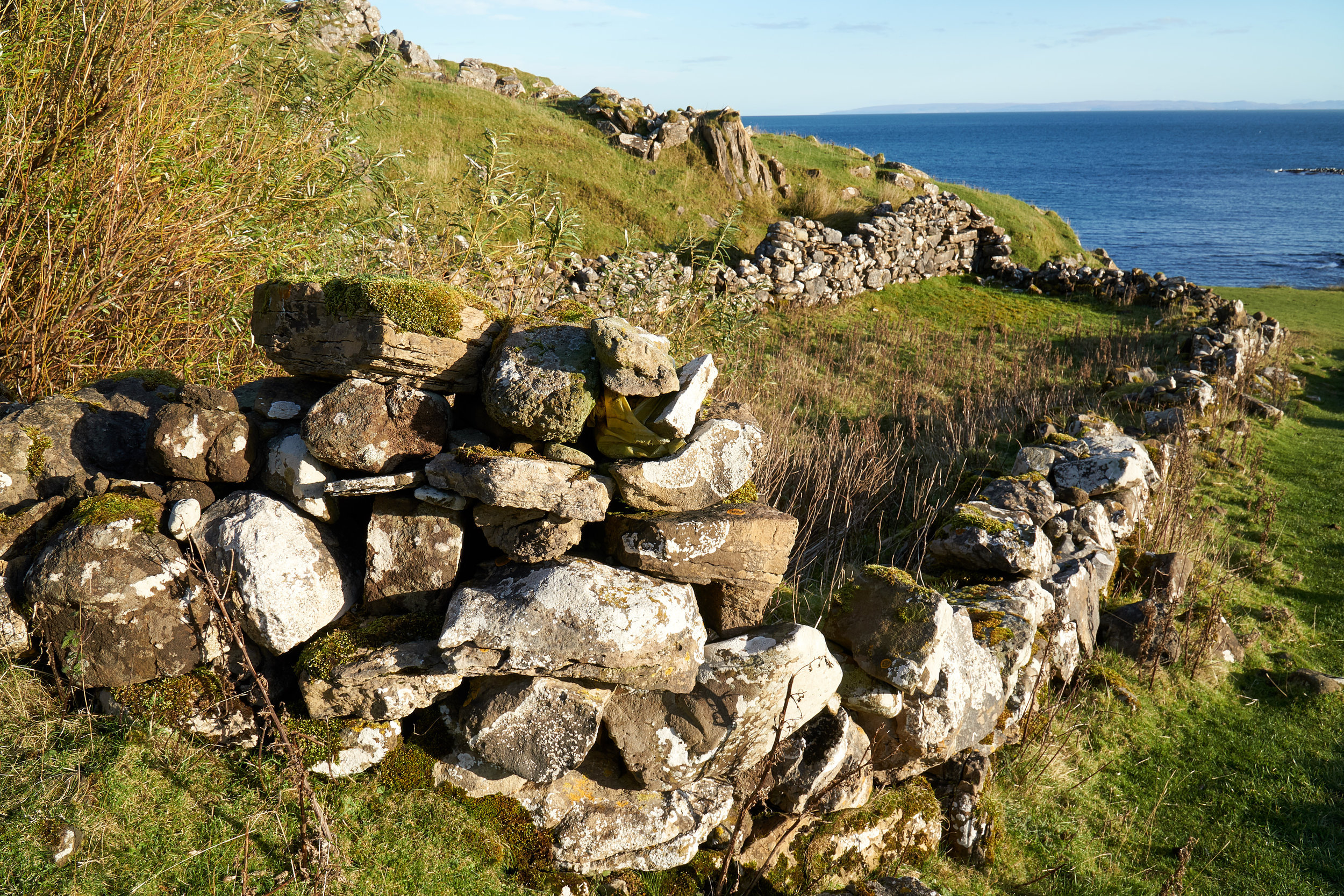
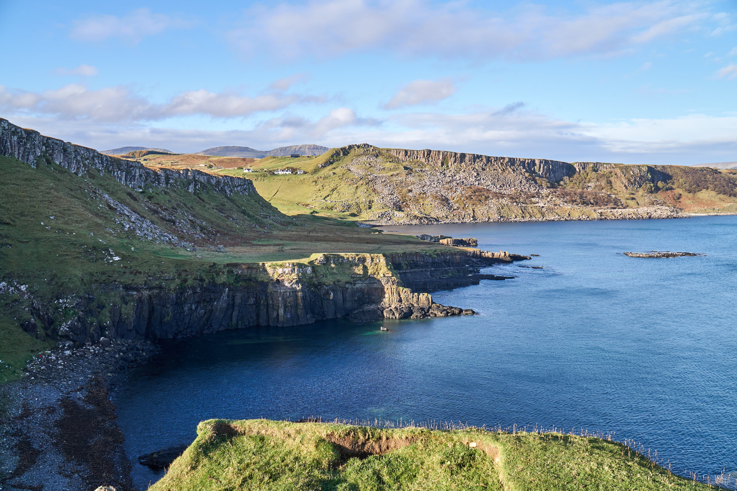
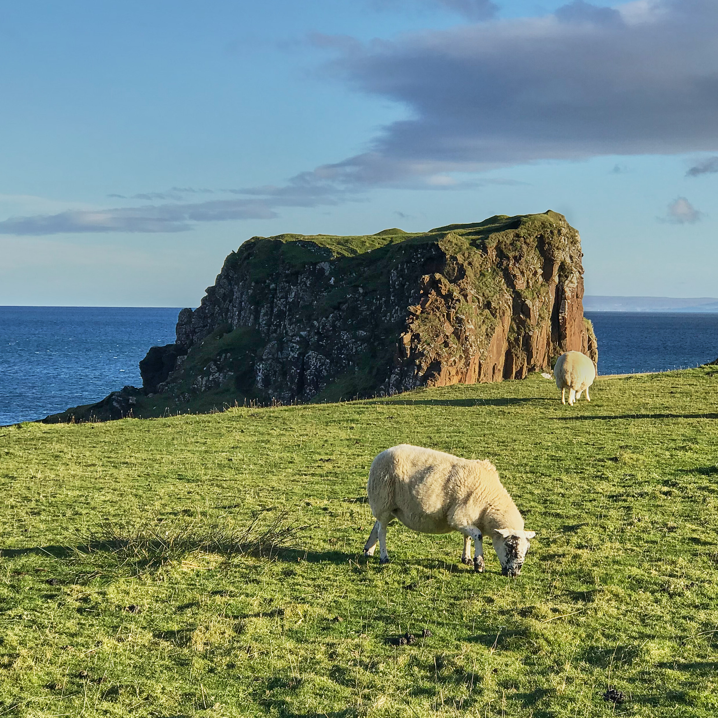
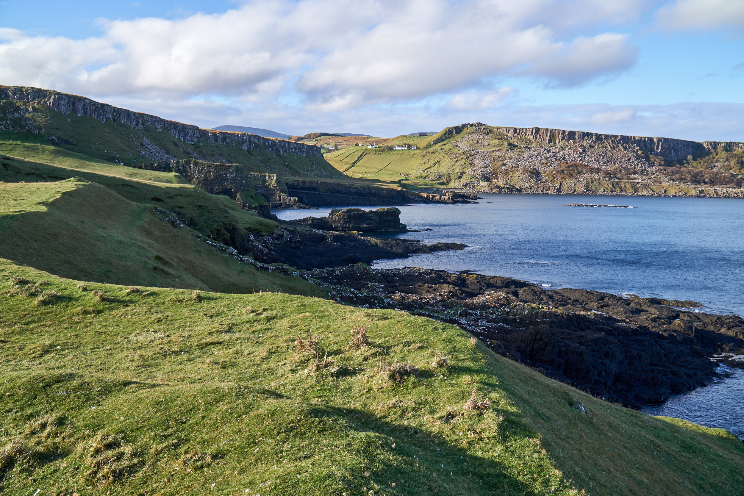
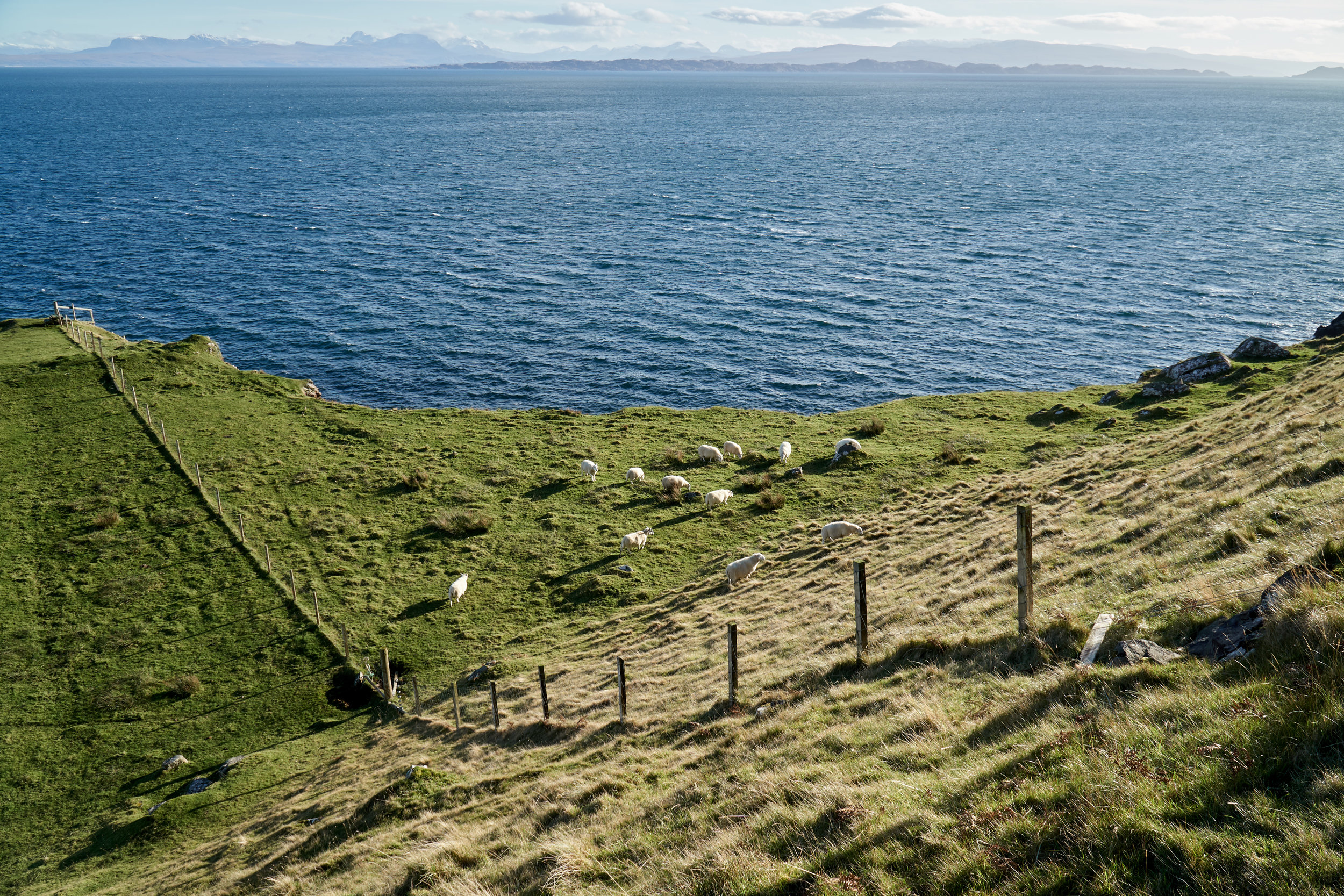
There are a few buildings on the right hand side as you make your way down a driveway. There will be another footpath sign that you follow to the right, then you fork left on a pathway that takes you downhill towards the coast. These are the only signs for the rest of the hike! But it’s easy to find, and the footpath leads you through some farmland down to the coast. As you make your way down the hill you pass by some old ruined stone buildings and a bunch of cute sheep. At this point you can see the peninsula to your right, and that is your ultimate destination for the hike.
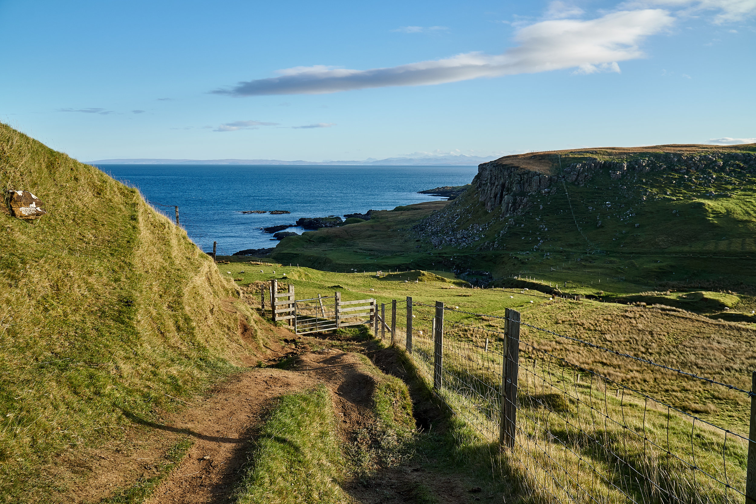
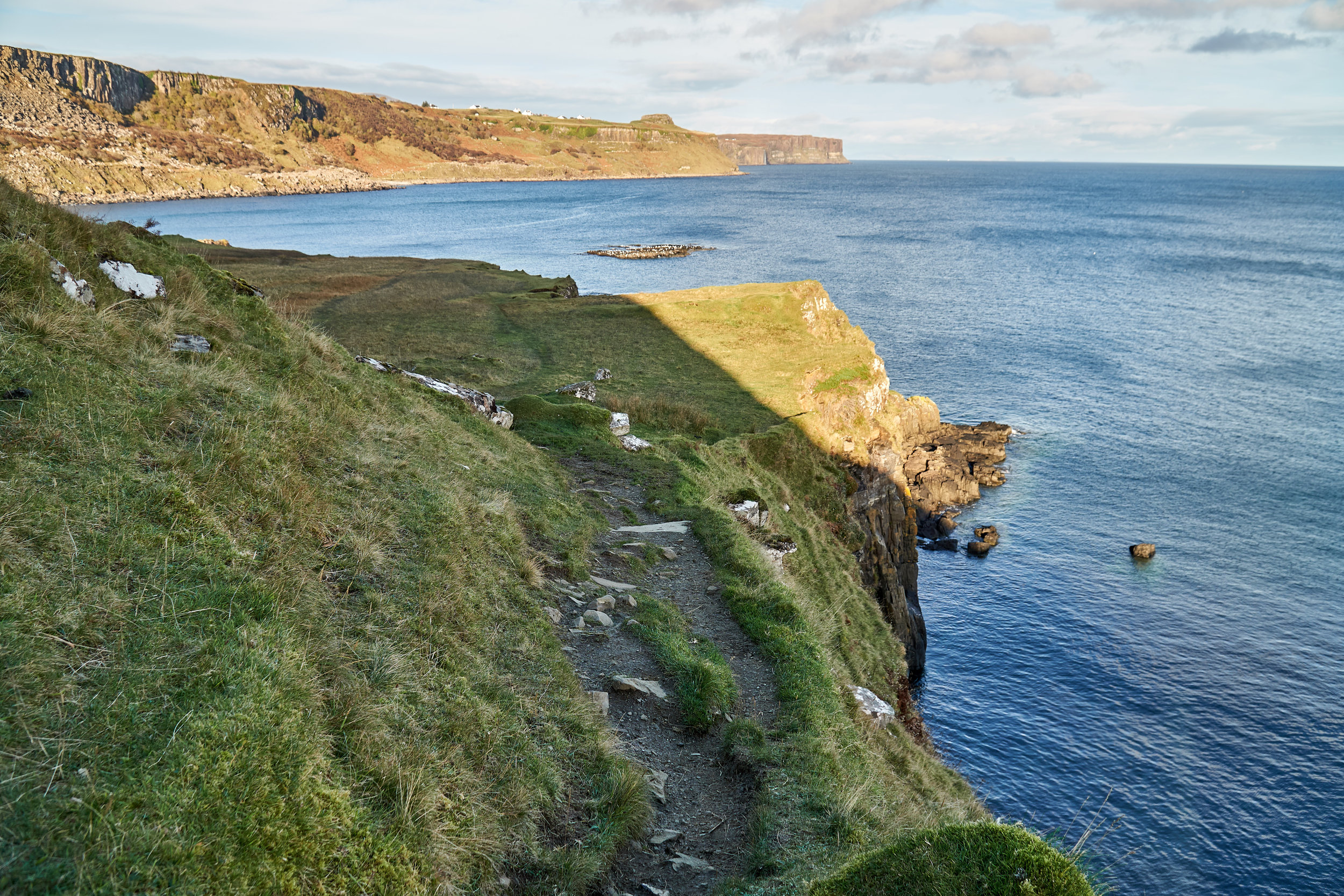
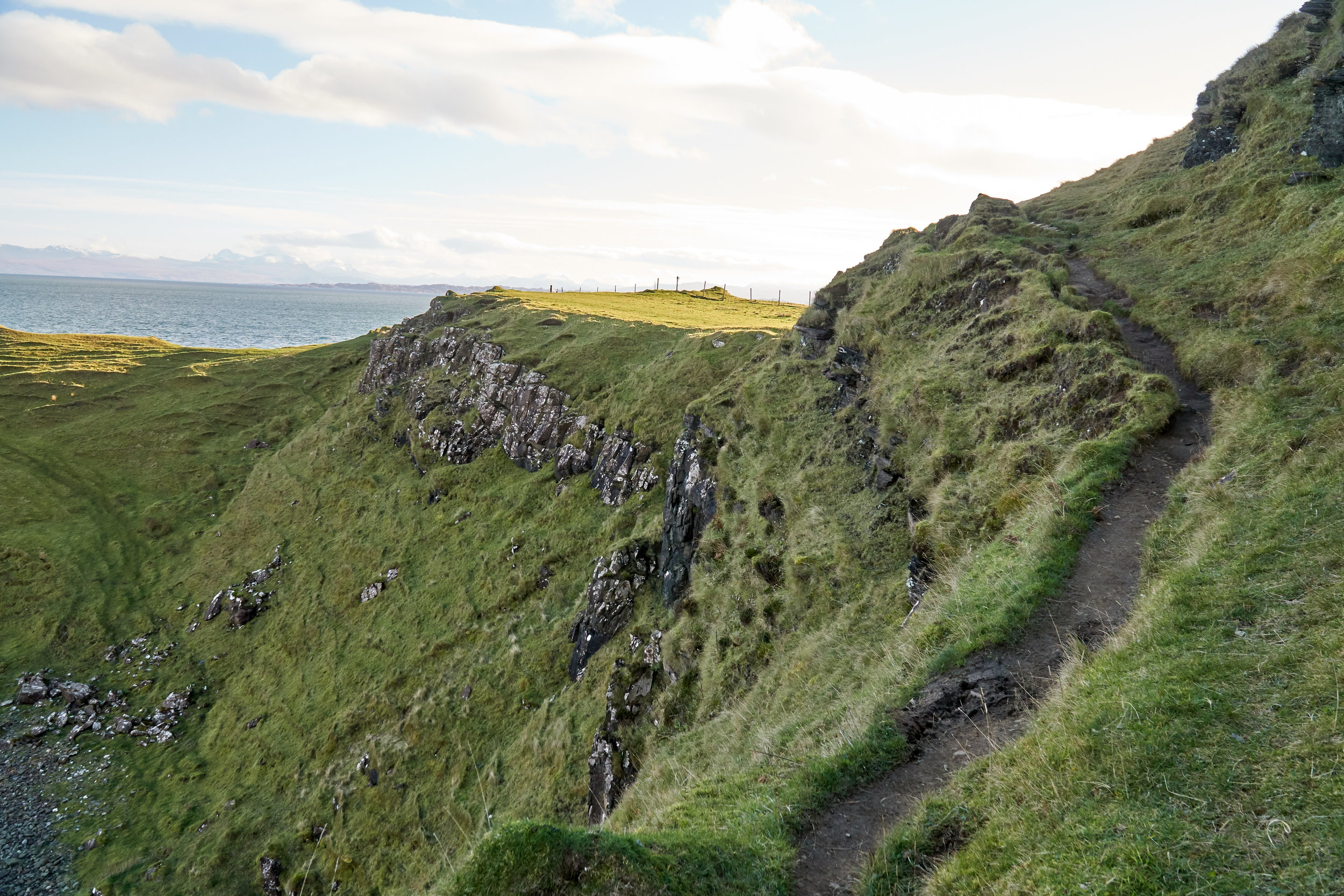
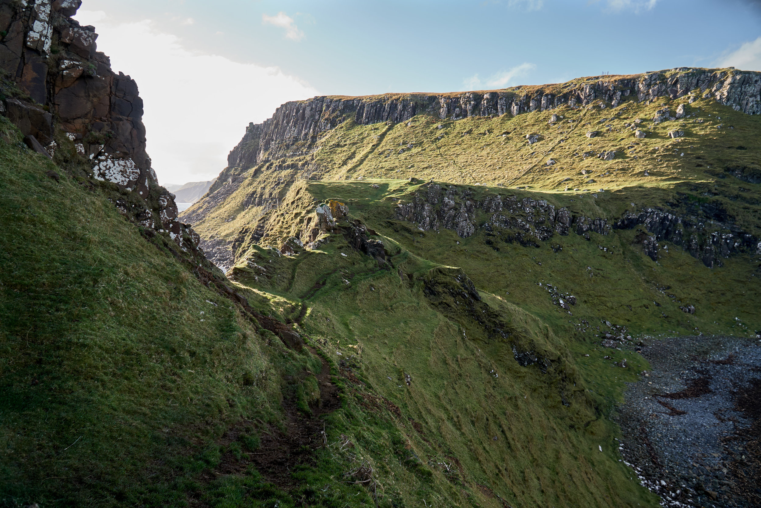
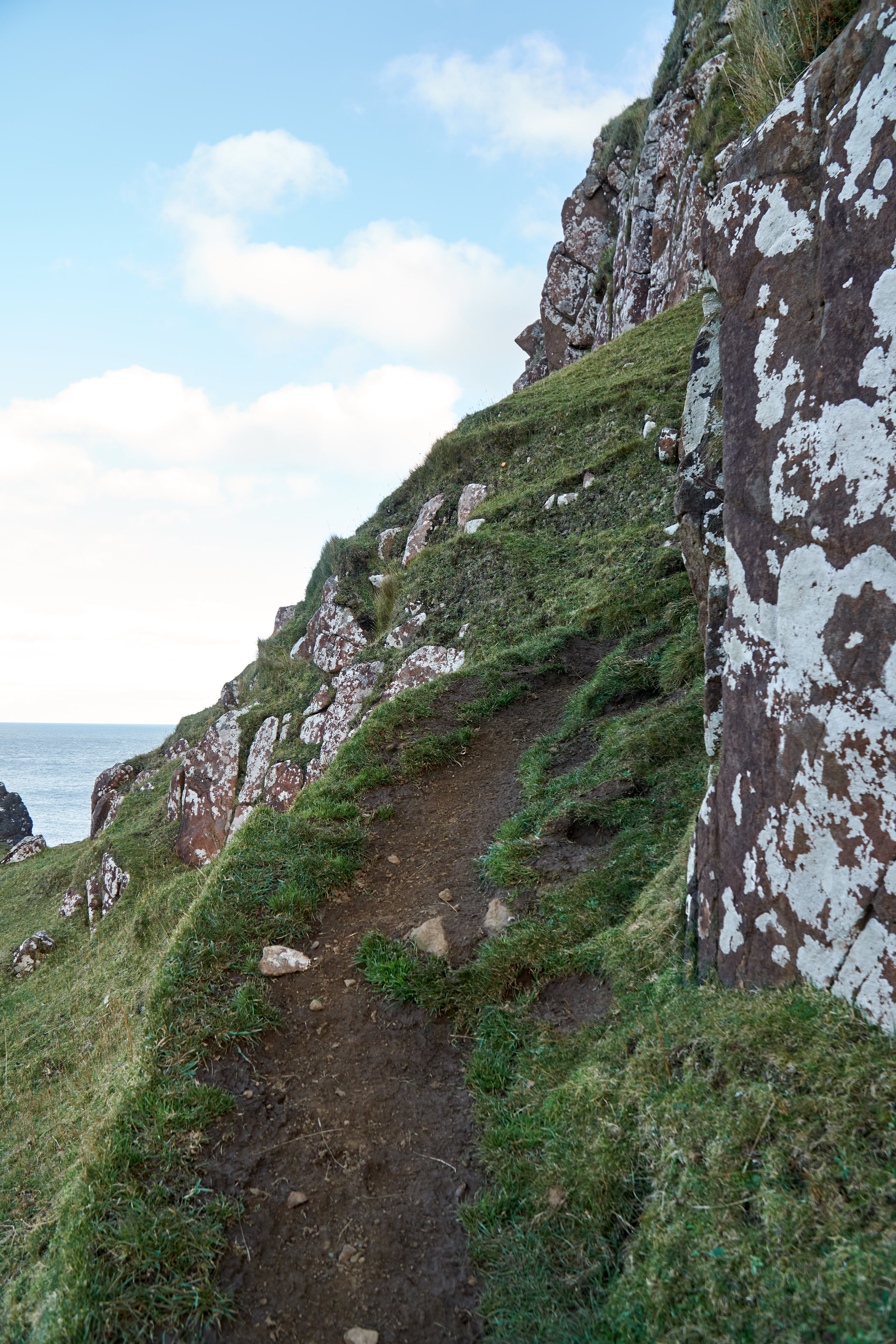
The pathway ends just before you reach the shore. For the next part of the hike you walk along the pebbly coast. It can be quite wet, so waterproof footwear is definitely recommended! There are stream crossings and underground streams that make the walk muddy and boggy. After about 100 meters you leave the pebbly coast and go up a grassy hill towards the peninsula. Again, there are no footpath signs or pathways, but it is relatively easy to find your way as you can clearly see the peninsula. You just need to make your way there!
The grassy portion is very boggy, almost swampy. Fortunately we got past the boggy area relatively quickly, and found ourselves up towards the cliff ledge close to the peninsula.
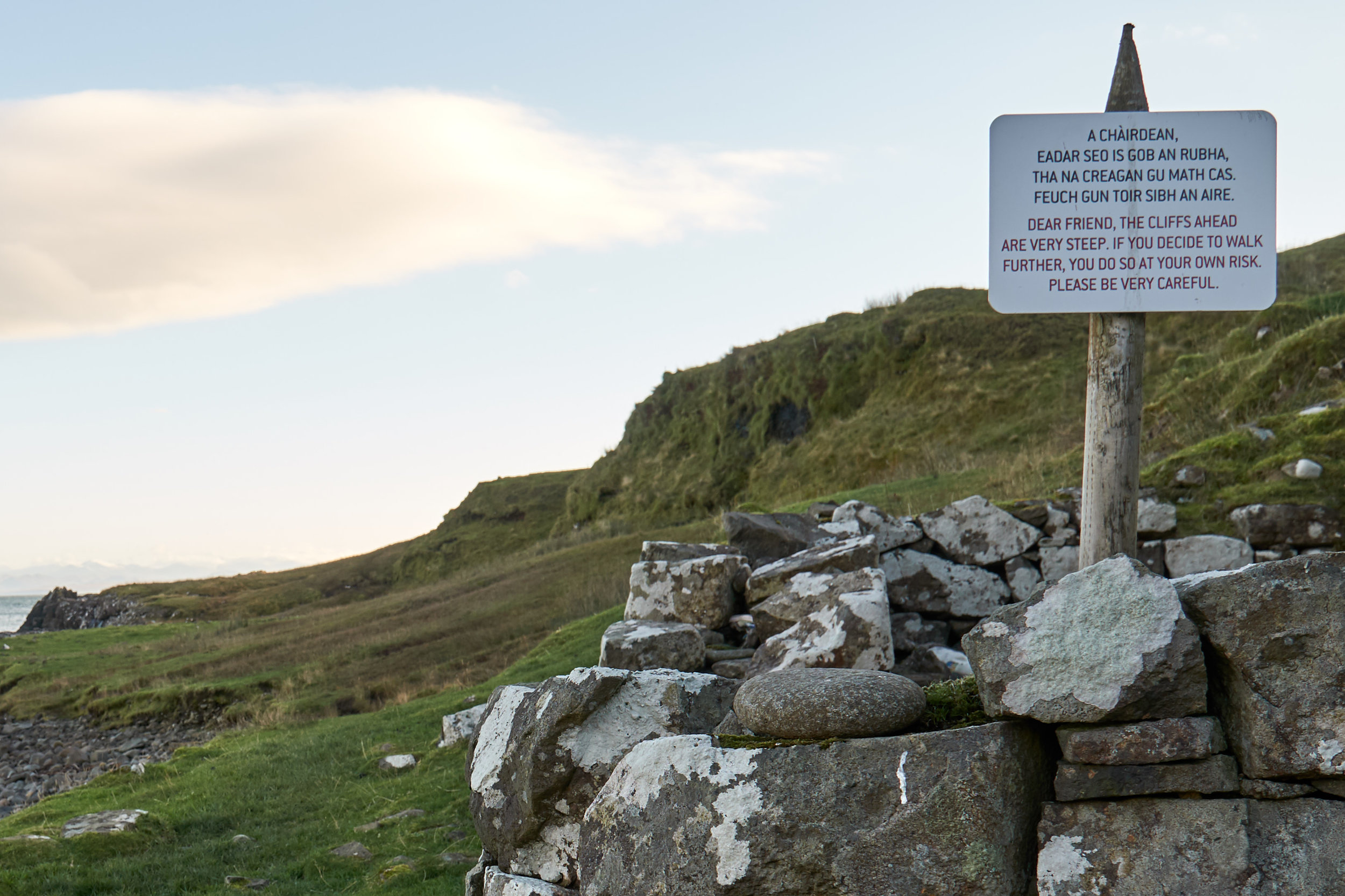
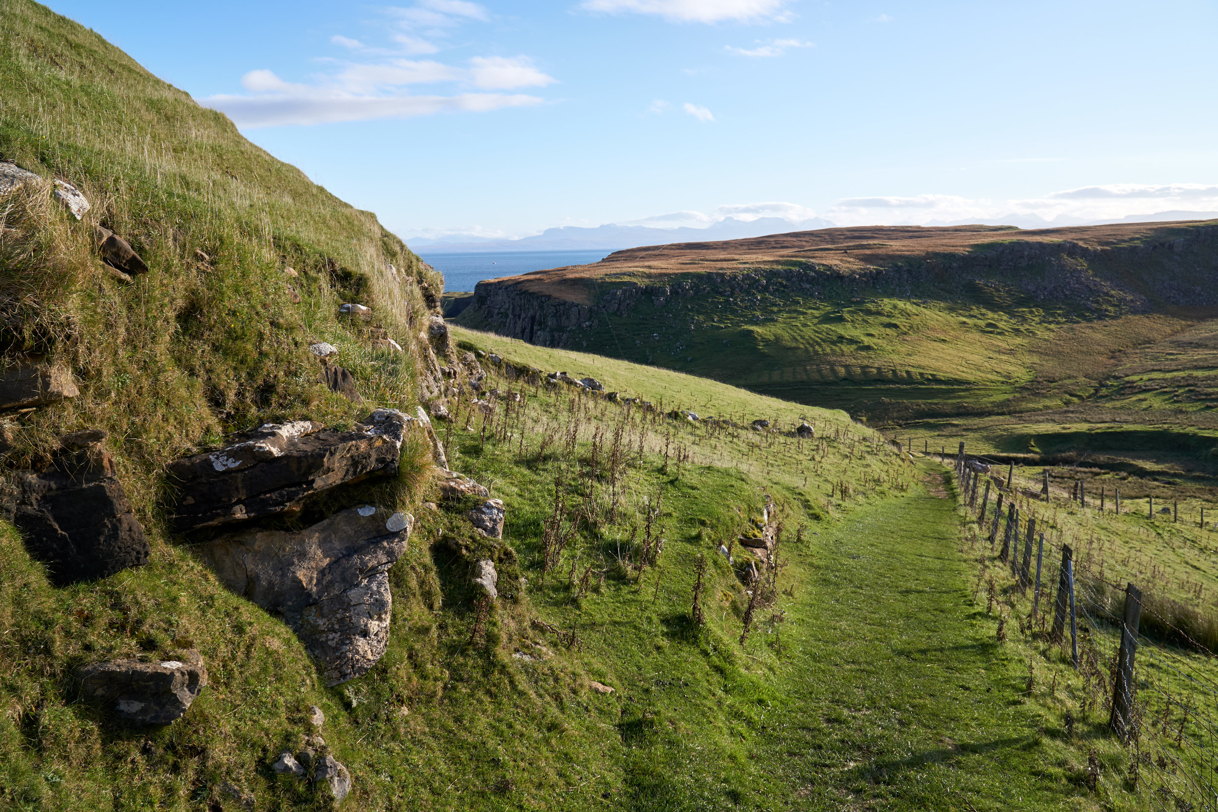
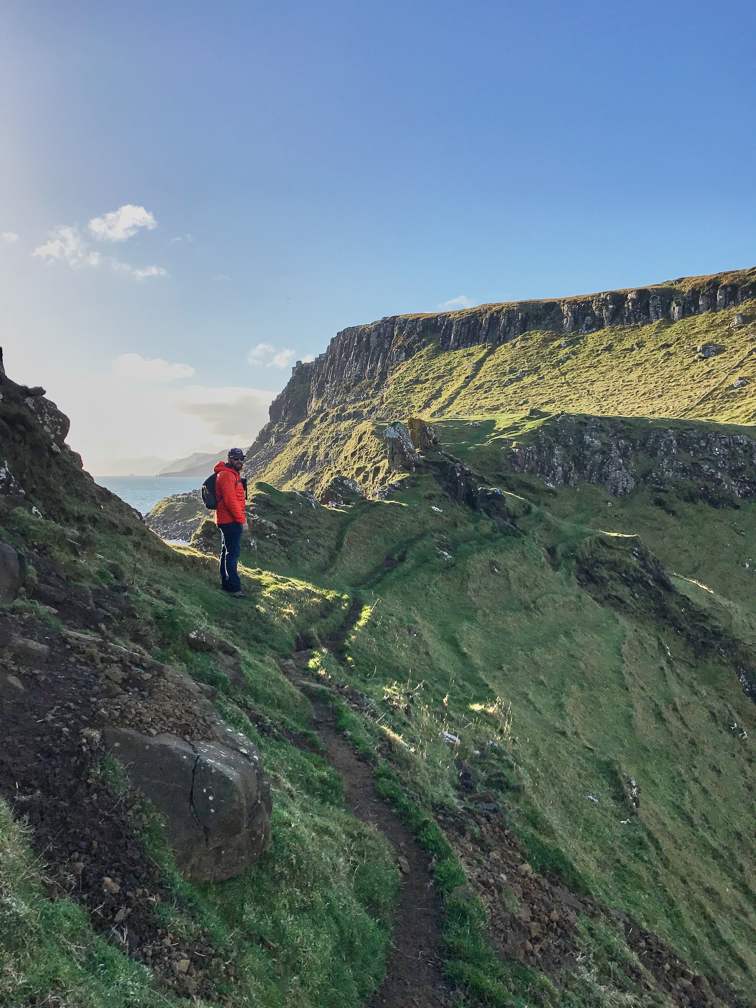
This part of the hike was really cool. There is more of a footpath during this section as there is only one way to the Brother’s Point peninsula. You need to walk along a cliff edge for about 50 meters, and there really isn’t a lot of space between the path and the edge. For the most part we didn’t find it too scary, however there is one section that does get quite close to the edge, so take your time and make sure you have appropriate footwear. We should note that we visited on a beautiful sunny day, so definitely take appropriate caution if you are doing the hike in rainy weather.
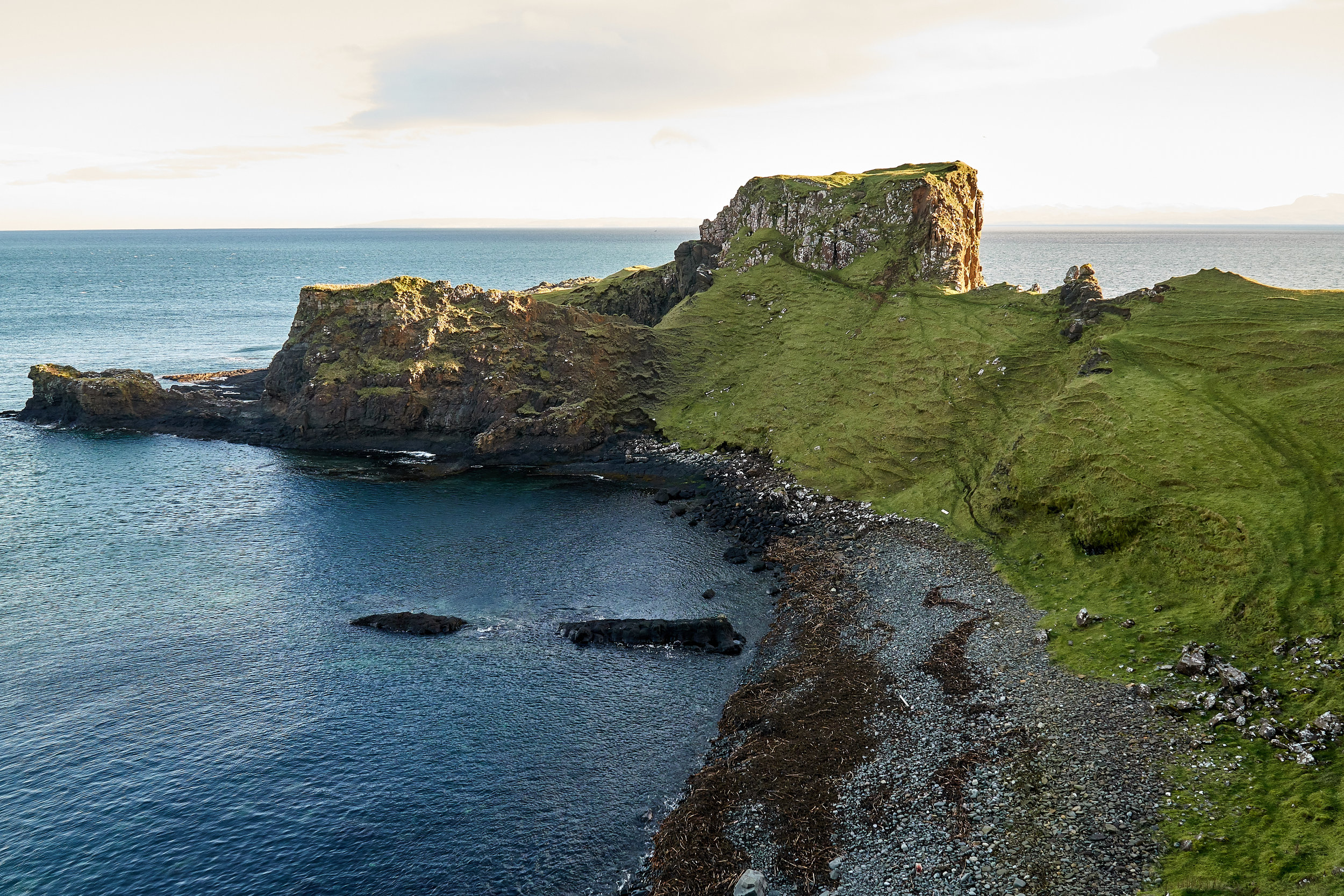
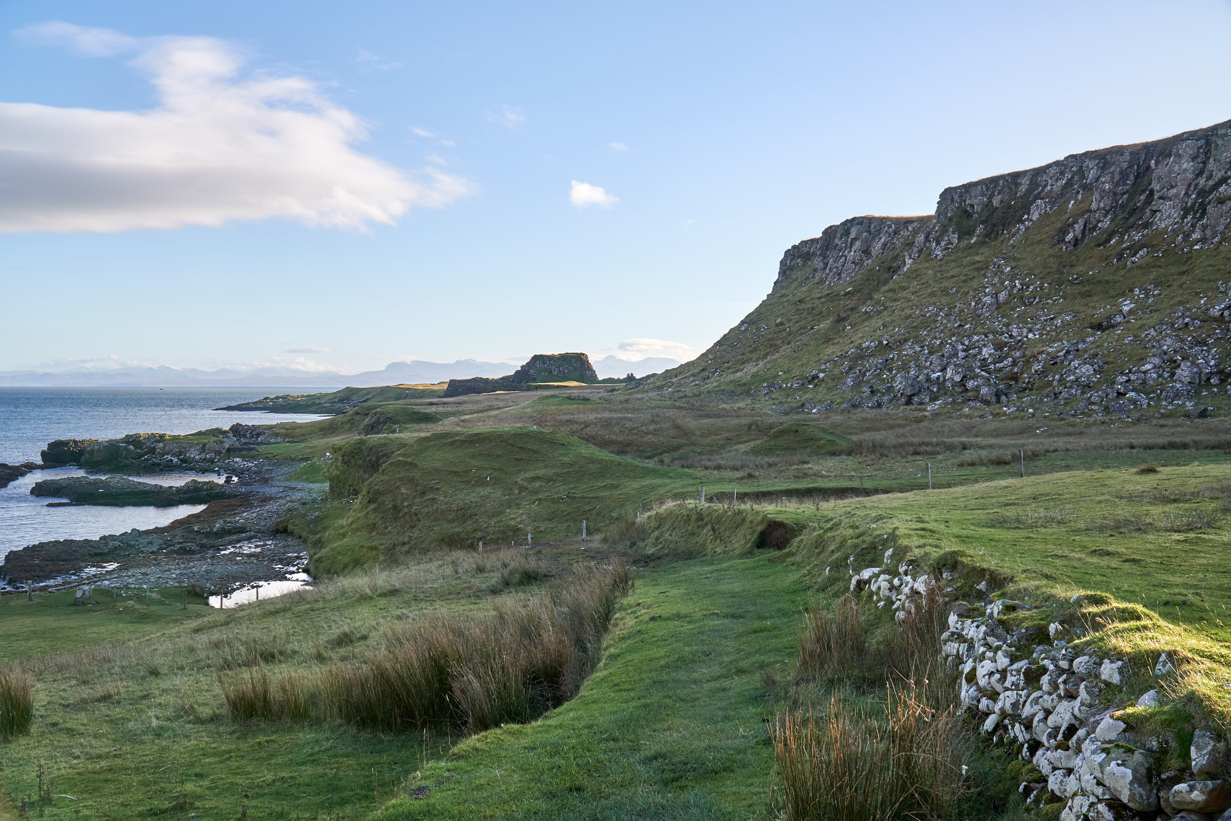
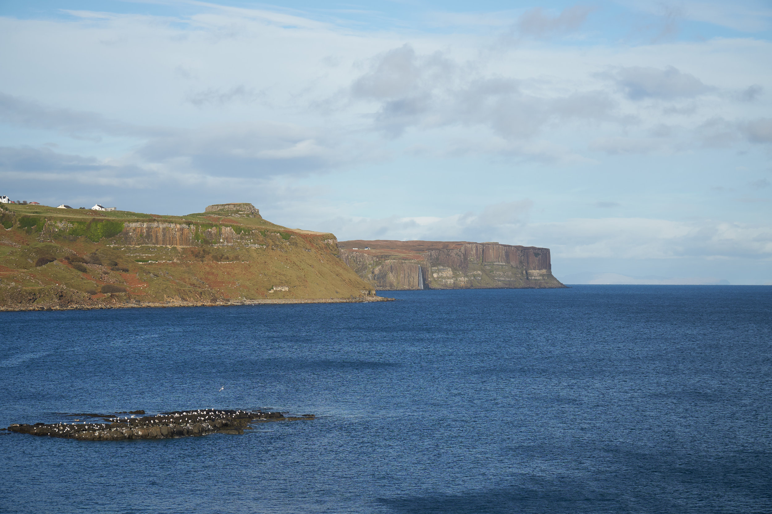
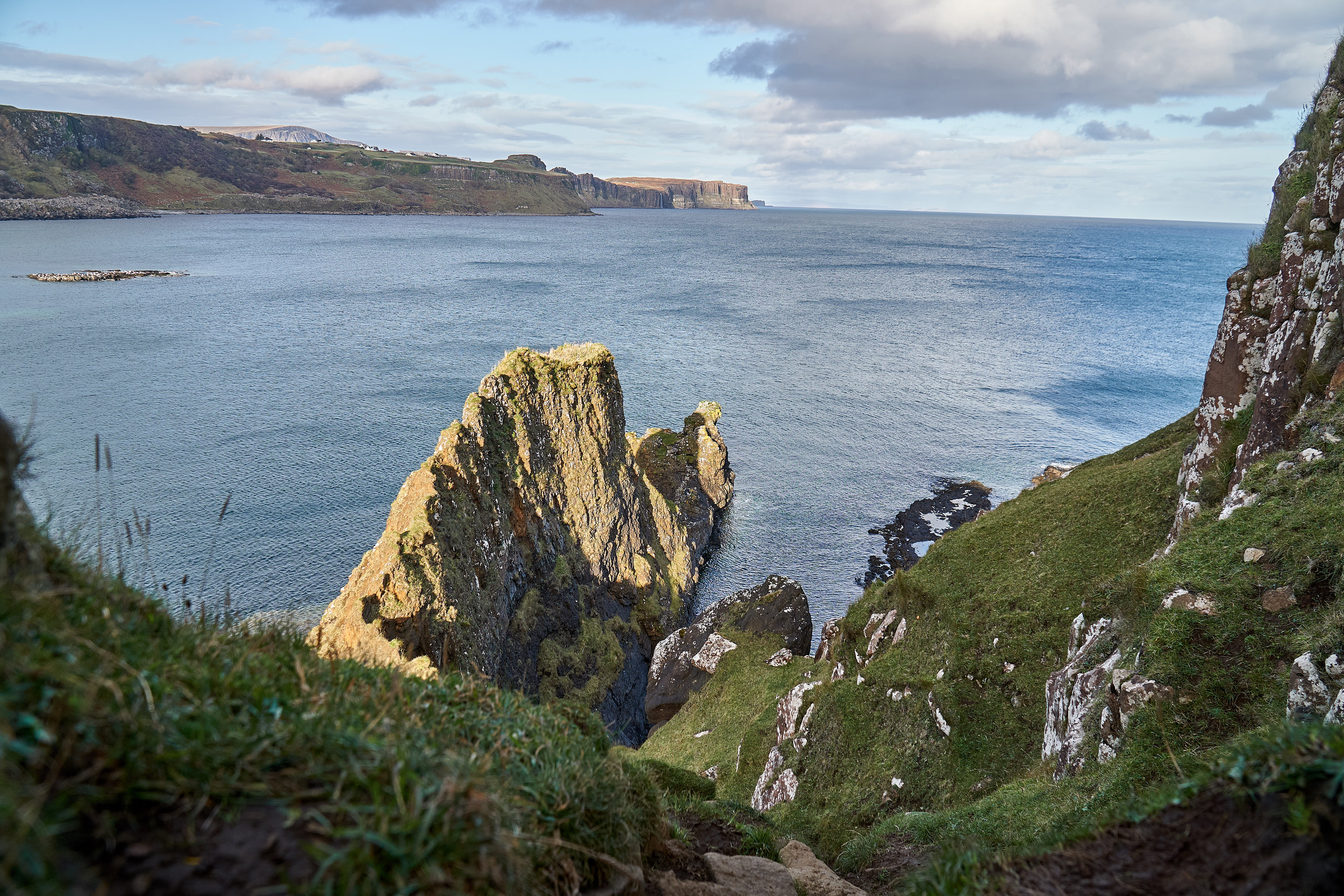
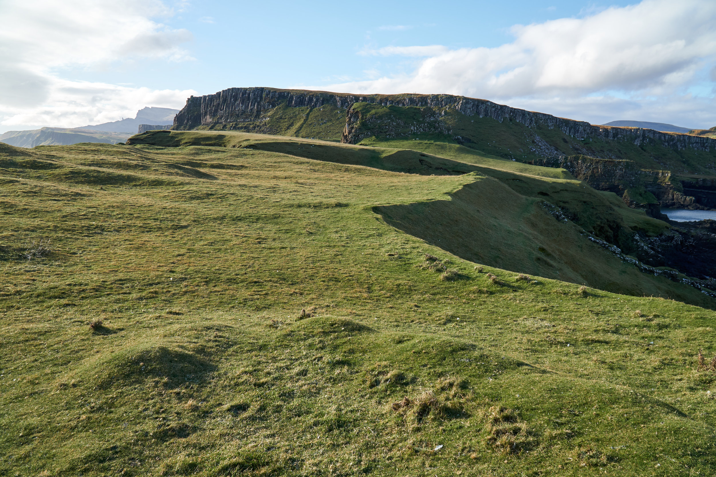
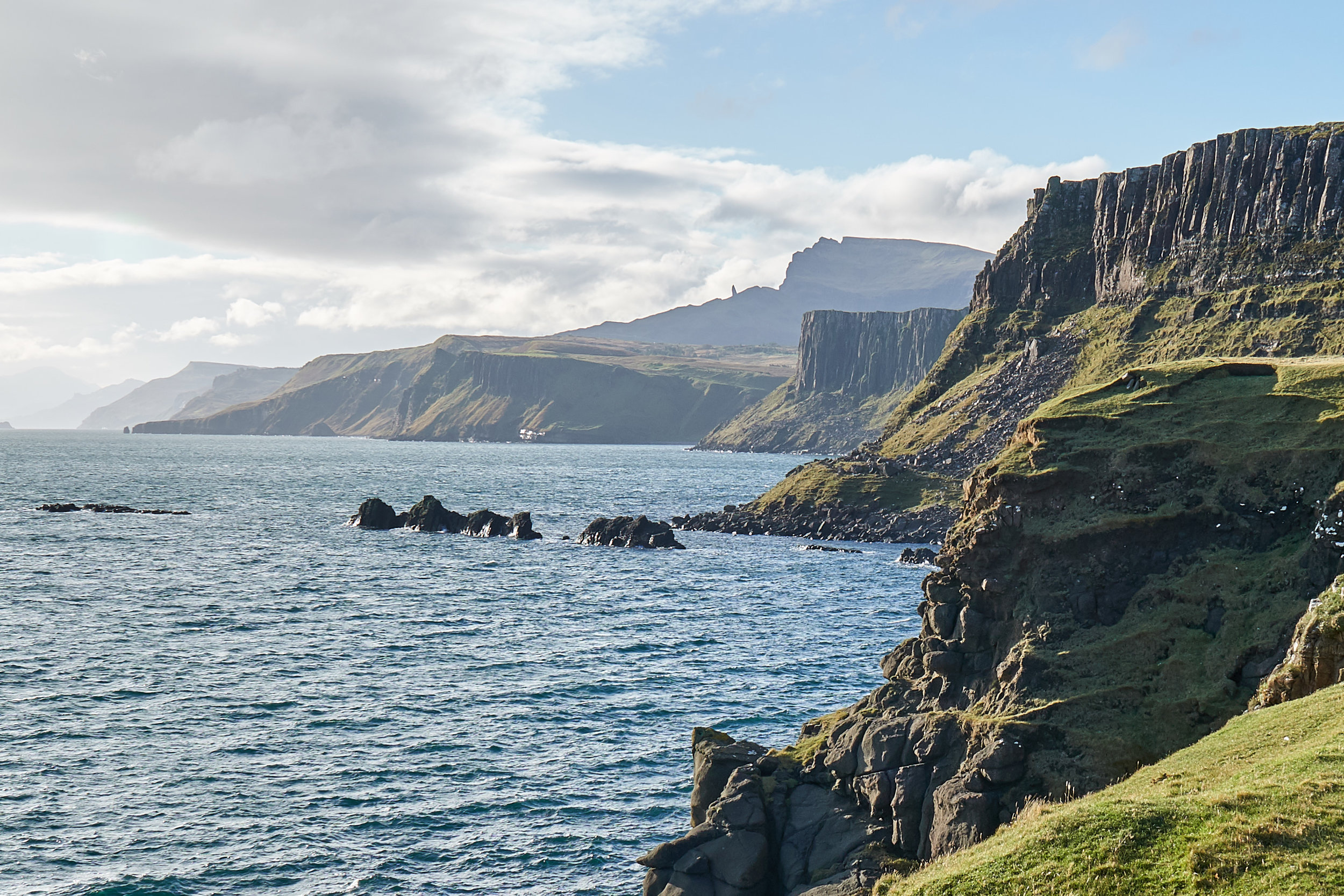
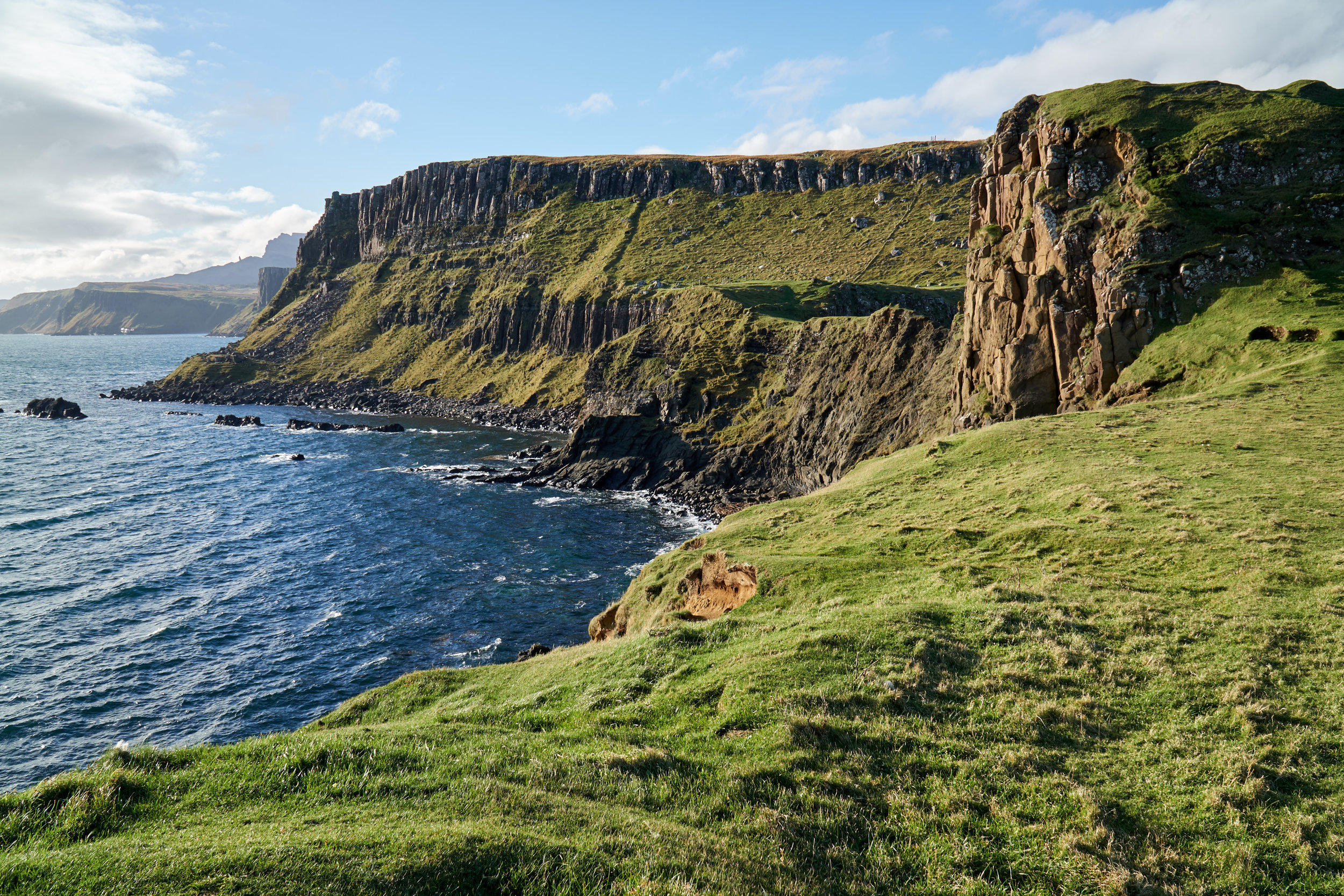
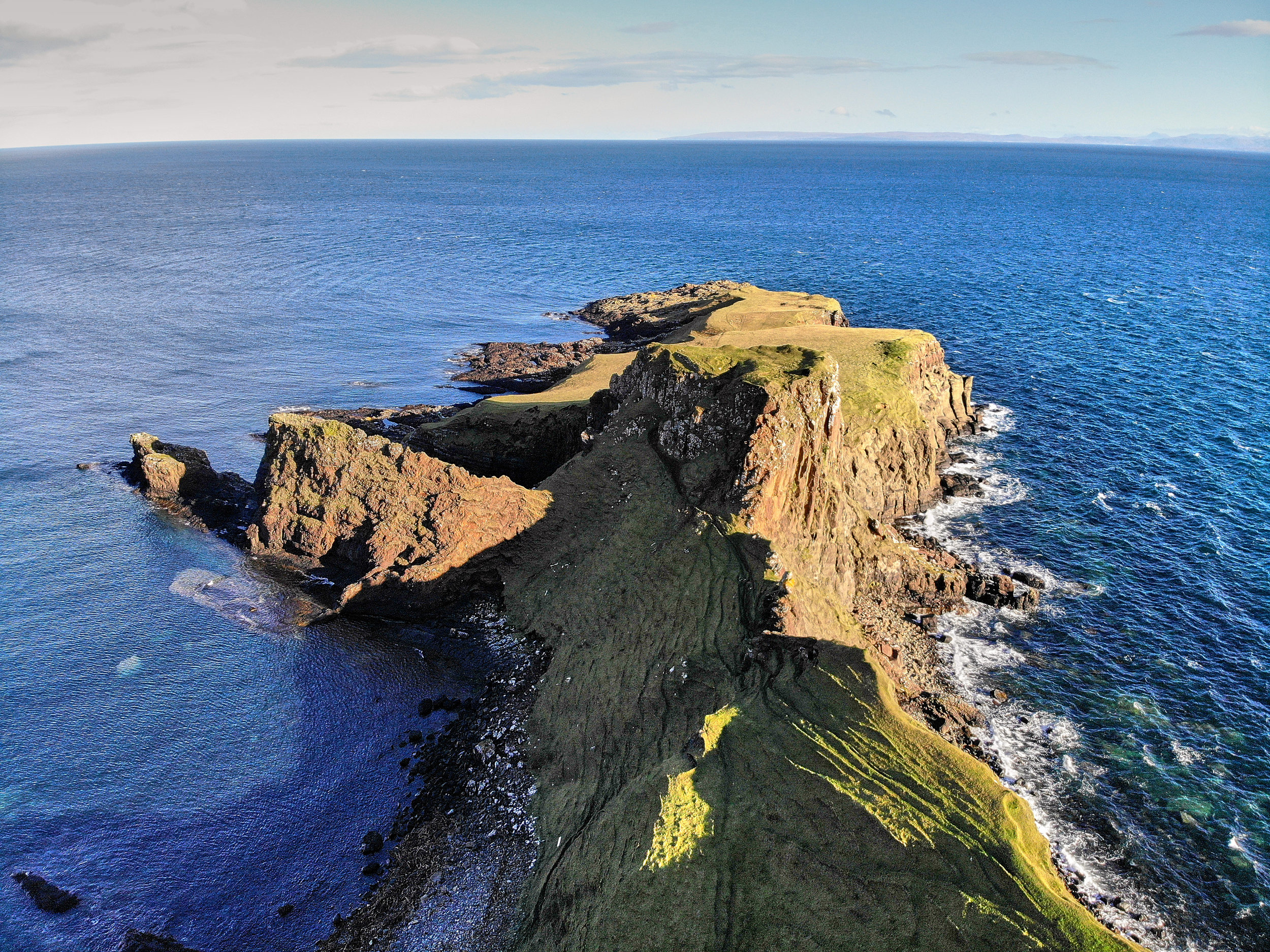
Once you pass the cliff ledge, you arrive at a nice flat green space at the base of the peninsula. You get a great view of the peninsula from here. If you look to the left you can also see Kilt Rock and the Mealt Falls waterfall, and to the right you can see the area near the Old Man of Storr (you can see the Old Man of Storr if you walk out onto the peninsula). If you are scared of heights or don’t enjoy climbing, these is a good place to enjoy the views before heading back towards the coast. We wanted to explore the peninsula so we made our way towards the tall middle section, called Dun Hasan.
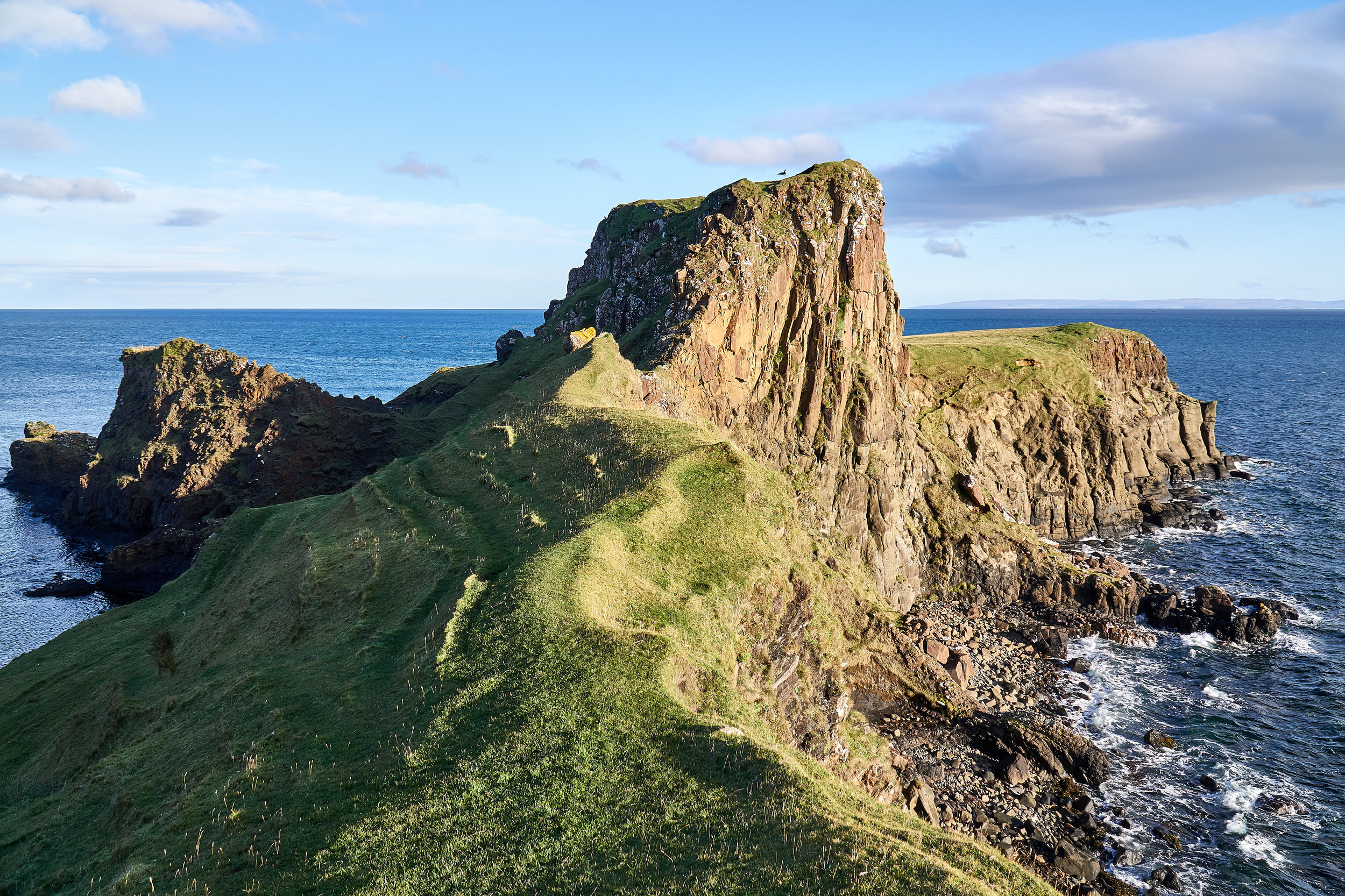
It was a steep climb up to Dun Hasan, but we felt safe the whole time. Again, the weather was perfect and there was hardly any wind. If it were rainy or windy we definitely wouldn’t have gone, because you do climb along a few cliff ledges. Once we reached the top of Dun Hasan we had great views of the cliffs along the south side of the coast. They were really dramatic and beautiful! We could also see Old Man of Storr, which was really cool! Dun Hasan is surprisingly flat. It was once used as an ancient settlement and the site of a medieval fortress. We couldn’t find any ruins, however we could only imagine how crazy it would have been to have a fortress here!

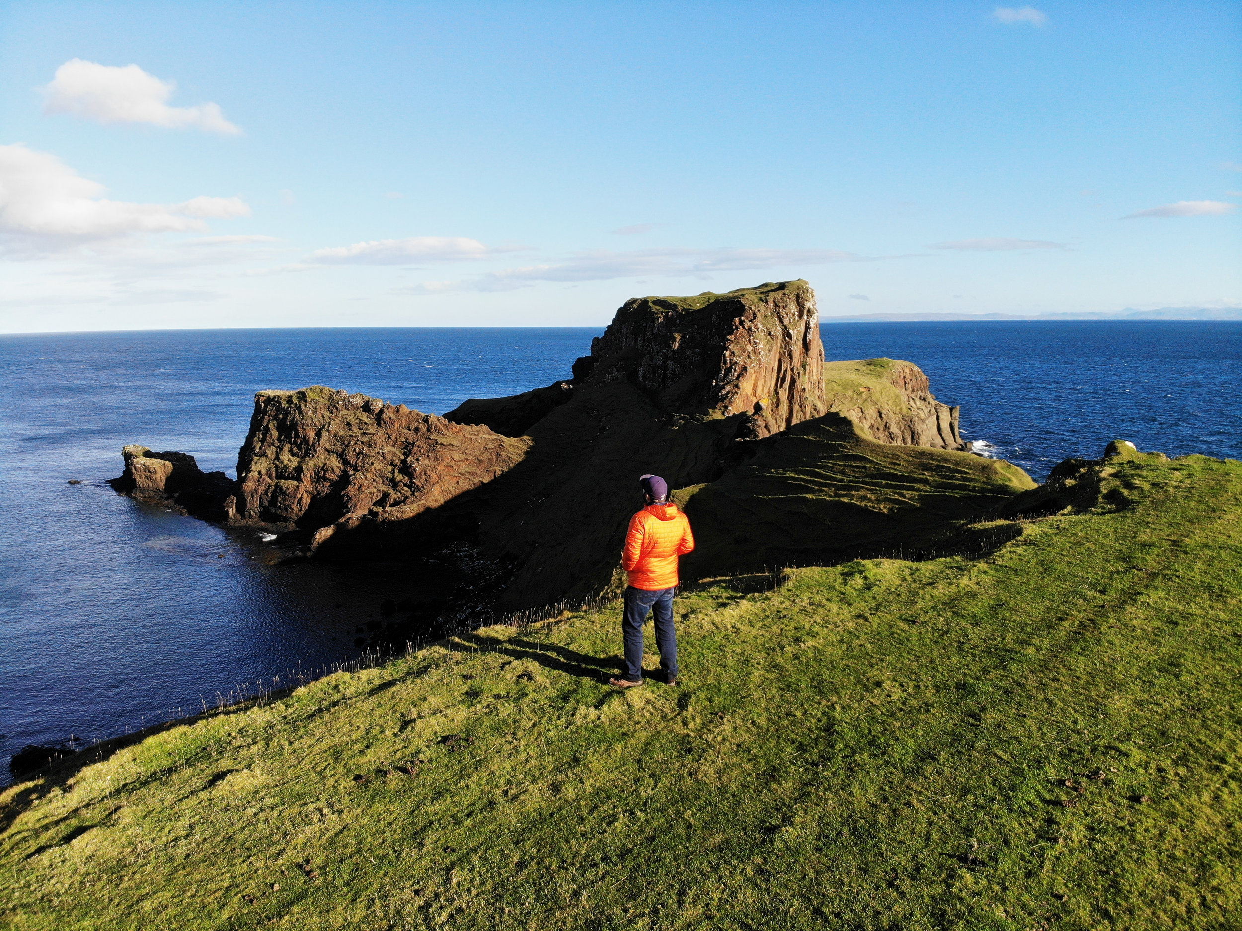
We continued to make our way along the peninsula and climbed down the back side of Dun Hasan. This section was a lot easier, and below us was a green space so it wasn’t as scary as the climb up the other side. At the far end of the peninsula is where the dinosaur footprints were found, or at least where we thought they would be based on the information we read online. Since they are newly discovered there isn’t a lot of information on them, and we couldn’t find any signage on the peninsula to help us find them. We didn’t look too hard as we were visiting during high tide and had read that you can only see them during low tide. To be honest, we had no idea what we were looking for!
After spending some time at the edge of the peninsula we made our way back up to Dun Hasan and then climbed down to the base of the peninsula. Since the weather was pretty good we decided to fly the drone for a little bit and continue to enjoy the views. We were joined by a bunch of sheep, which made for such cute company!
To get back to the car park you follow the same route you took to reach the peninsula. Overall the route is about 3.5 kilometers. If you walk out to the edge of the peninsula it is probably closer to 4.5 kilometers. It is relatively flat other than the beginning/end hill section, and the climb to Dun Hasan if you choose to head onto the peninsula.
We loved the views from this hike, especially the beautiful cliff views on the south side of the peninsula. We also thought it was really neat to see the Old Man of Storr, Mealt Falls Waterfall, and Kilt Rock – three things we had seen in the few days before the hike. We also really enjoyed having the place all to ourselves. In the three hours we were there we didn’t see anyone else! We’ve heard it is also very quiet in the busy summer months too, so if you are looking to escape the crowds this is a great hike to add to your list when you visit the Isle of Skye.


