
Short Hikes on the Isle of Skye #2 – Quiraing
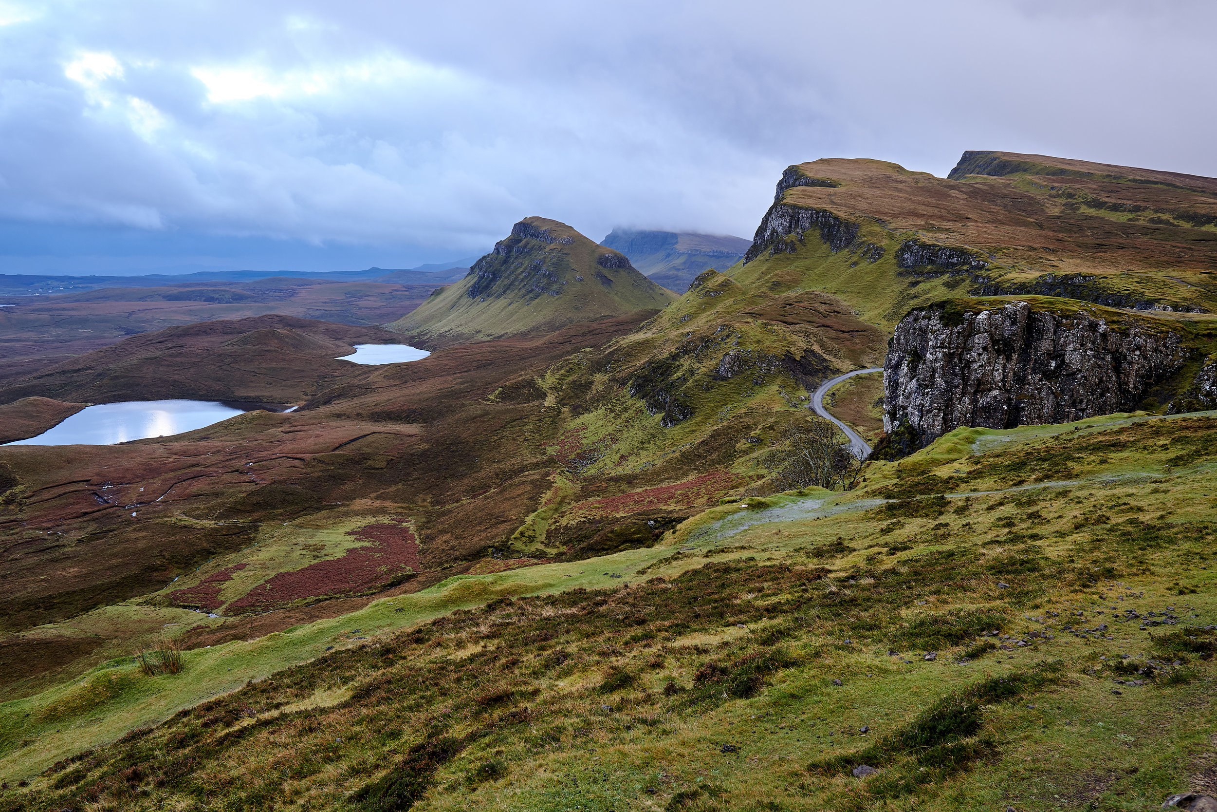
The Quiraing is a range of rock formations along the Trotternish Ridge – just north of Portree on the Isle of Skye. This area has been formed by huge landslides, which have created cliffs, plateaus, and rock formations. It is such a dramatic landscape! We first saw it when we drove across the Trotternish Peninsula, on a secondary road that passes through Quiraing. We couldn’t believe the landscape - it looked like something you would find on another planet! The colours of the hills and ground had changed, as it was the end of October and well into the autumn season on Skye. Everywhere we looked we found stunning colours of cooper, orange, red, yellow, browns, and greens. It was really beautiful.

After driving by it a few times and reading up on the location, we decided to go on a short hike and get a better view than what we could see from the road. Darrell was still recovering, so we didn’t want to do anything overly strenuous. We waited until our fourth day on Skye before heading out for an early morning hike. By this time we had also figured out how to pronounce Quiraing (it’s pronounced (Kwirr-ANG).
We were a bit nervous as the weather forecast was not supposed to be very good. We had lucked out at the start of our time on Skye with 4 clear days, but the last 3 days of our trip were supposed to be rainy and very windy. Quiraing isn’t the best hike to do in poor weather, so we wanted to get out early and see how far we could walk before the bad rain and wind arrived. We headed out with the best rain gear we had, and hoped for the best!
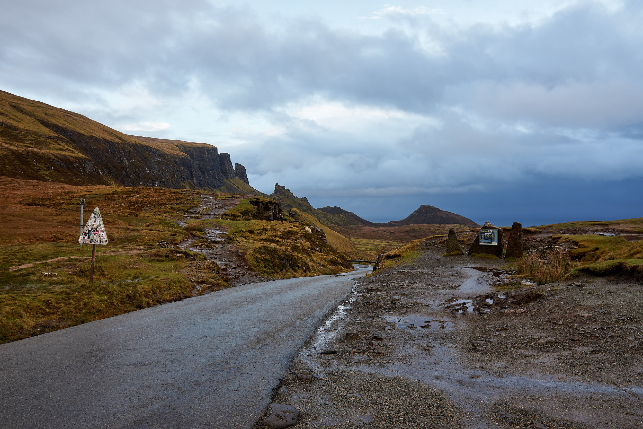
Just like other hikes on Skye, the earlier you can get out the better. These areas get really busy with tourists, and they are the types of places you want to see and enjoy without hoards of people. We parked our car around 7:45 am, just after sunrise, and made our way across the street to the well-marked pathway.
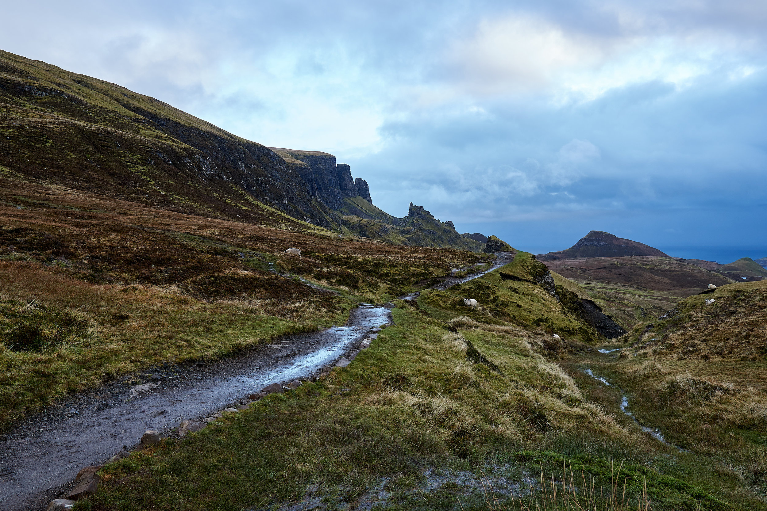
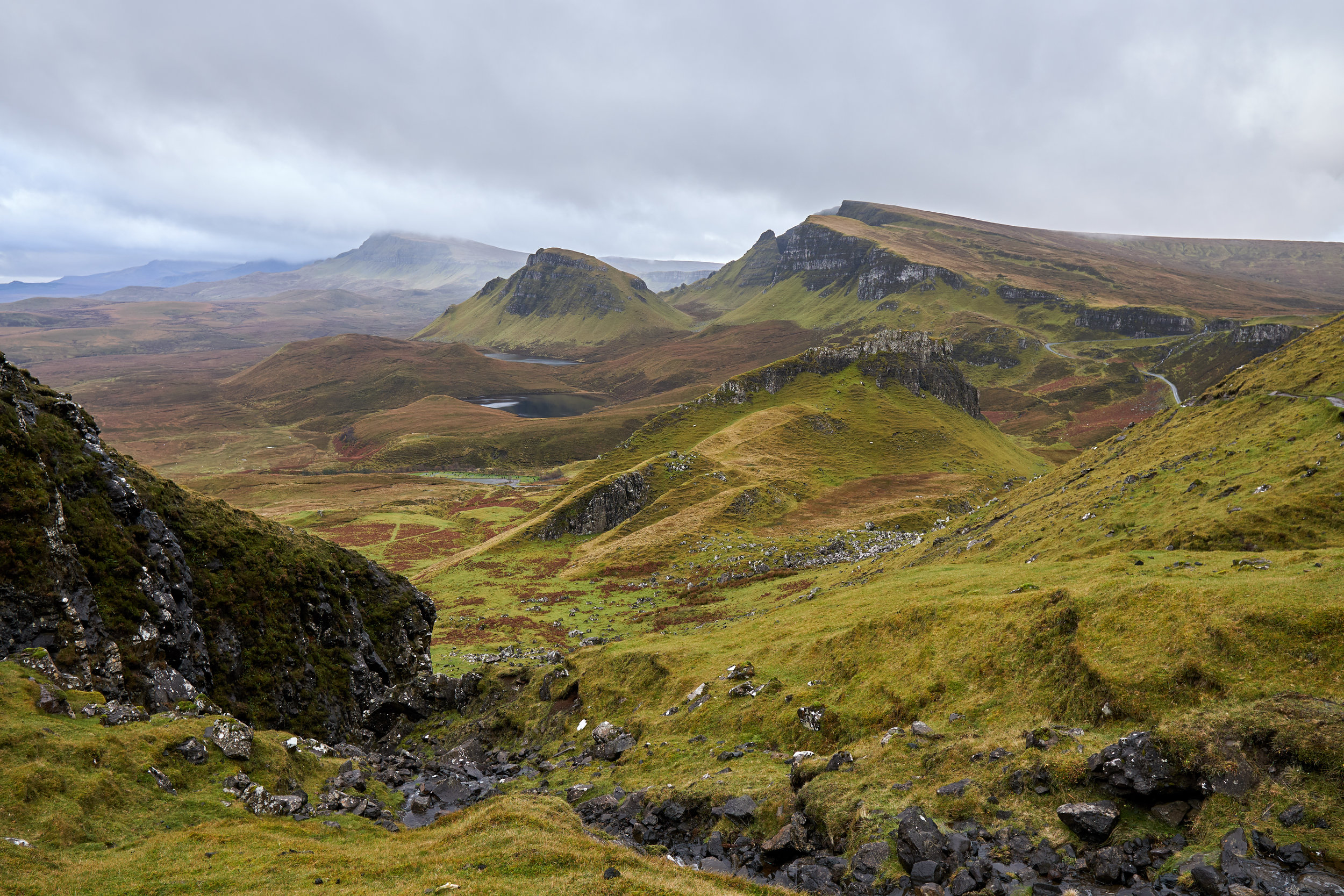
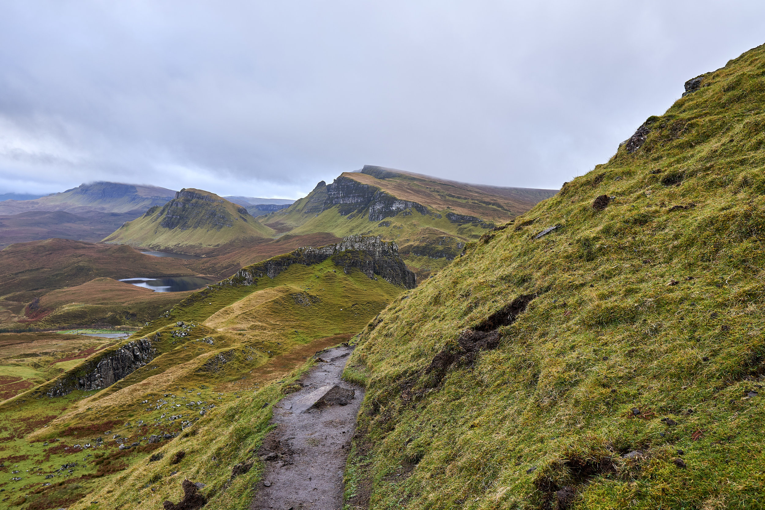
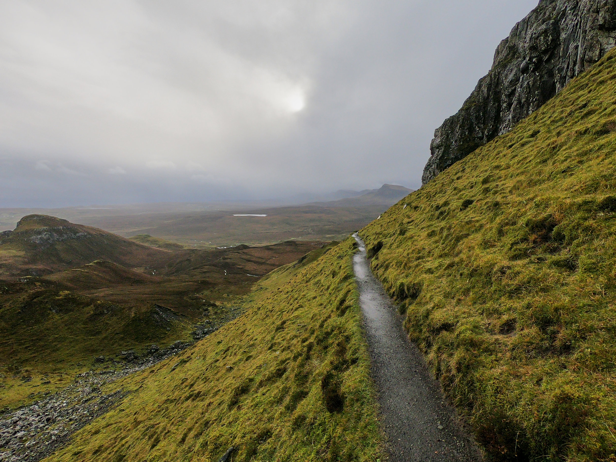
Right from the beginning the views are awesome. In fact, most tourists come to this point right across the car park to take in the views and take a few pictures before heading on to their next stop. The pathway here is a hiking trail, but very well marked and relatively flat. So if you can walk a few hundred meters it is definitely worth continuing a bit as the views just get better!
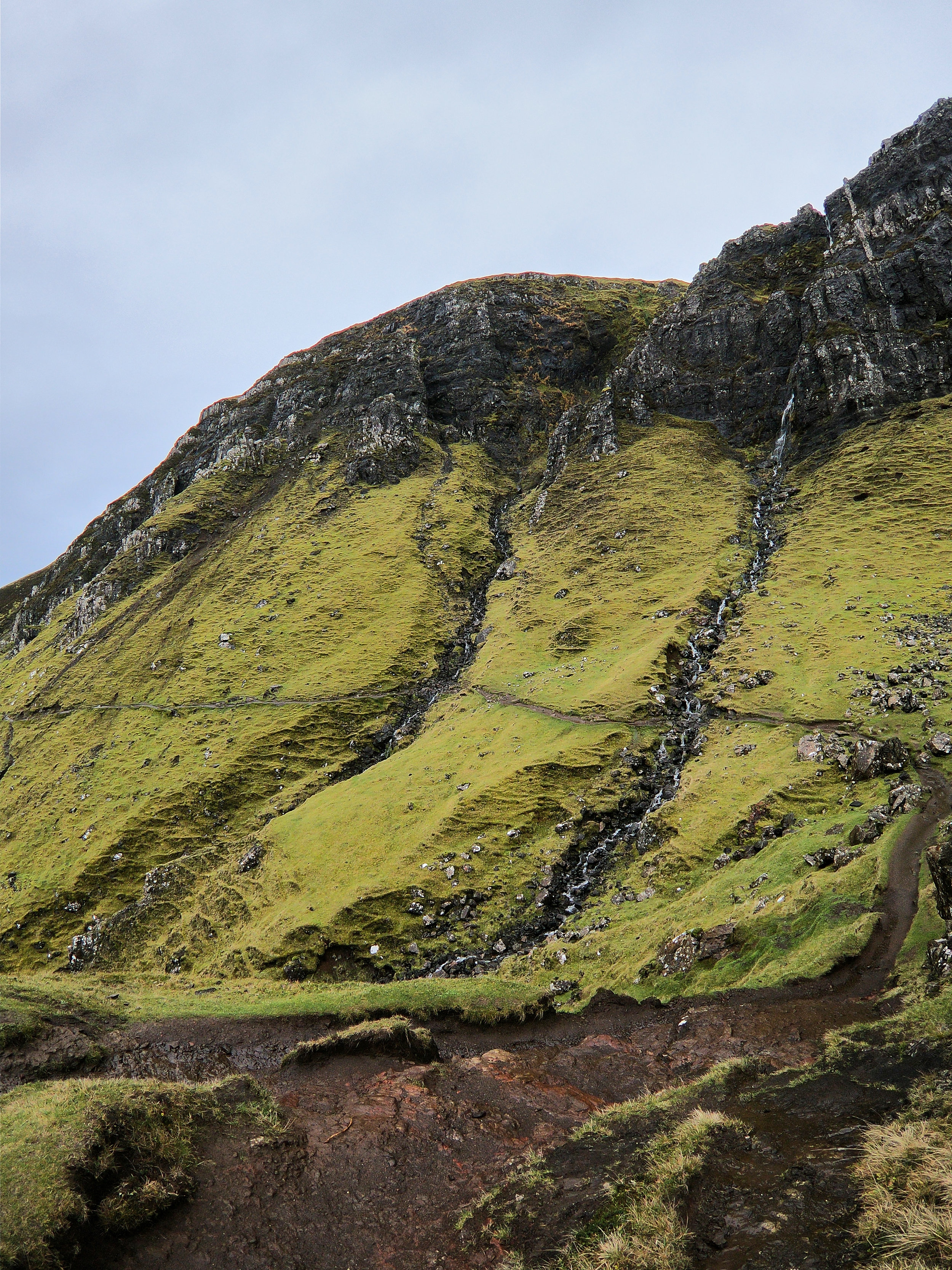
You can see the pathway halfway up the waterfall. The second crossing is the one that is a bit more challenging.
After a kilometer or so of walking we were still super lucky and some how escaping the rain. We were so thrilled! We also had the whole pathway to ourselves, there were two other people on the trail in front of us, but that was it! Right around the 1km point there is a beautiful waterfall on the left hand side. We had to cross over a small creek in order to stay on the path, which was the first “challenging” part of the hike. Anyone who has experience hiking will have no issues with this part, but it does require walking across some rocks to escape the water, and when it is raining it can be very slippery.
At this point we were quite distracted by the views to our right and slightly behind us. The cliffs and landscapes are beautiful at this time of year. With the morning light and dramatic clouds it made for some gorgeous sights! We had a lot of fun stopping and taking pictures, as well as pausing to absorb how lucky we were to be there.
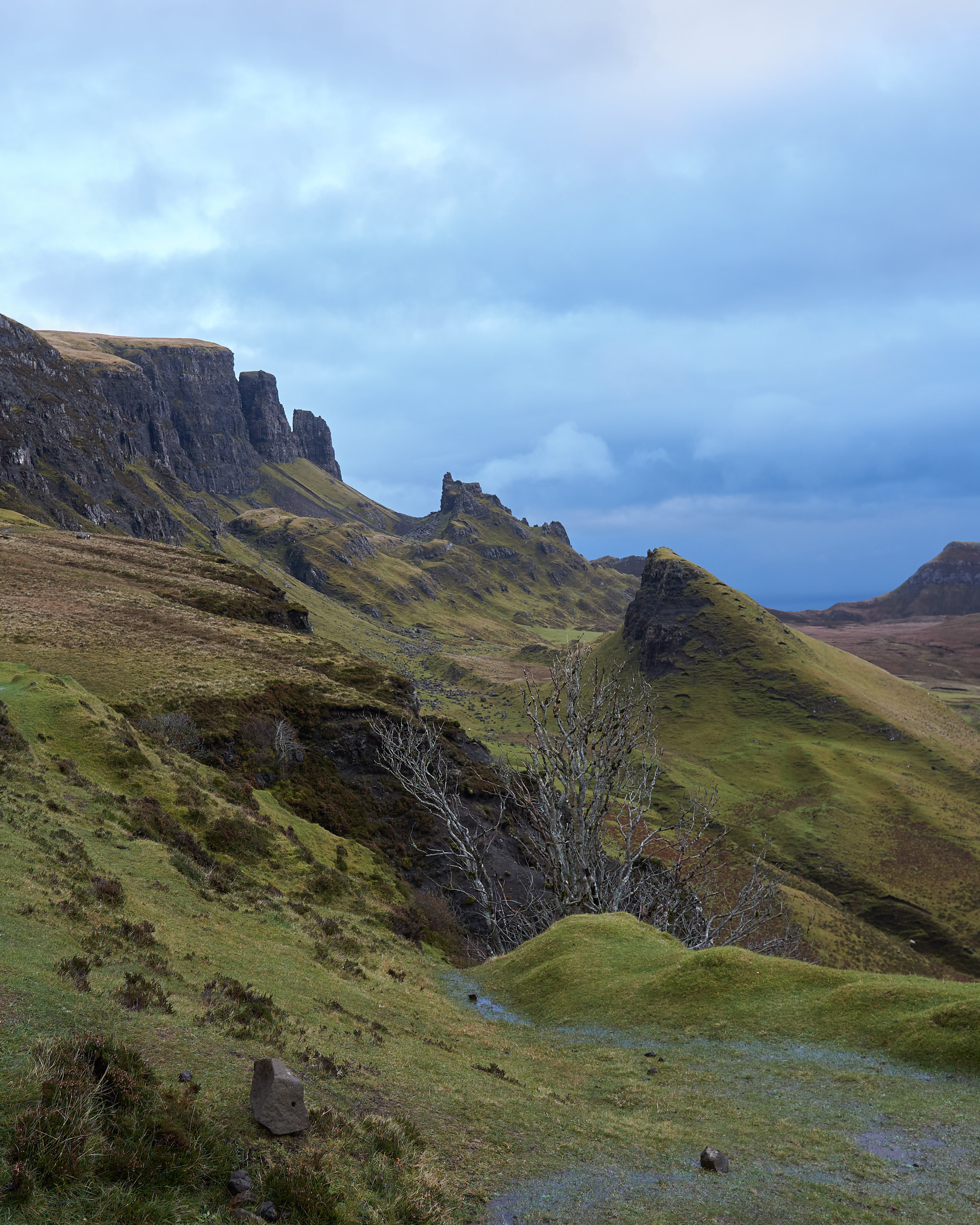
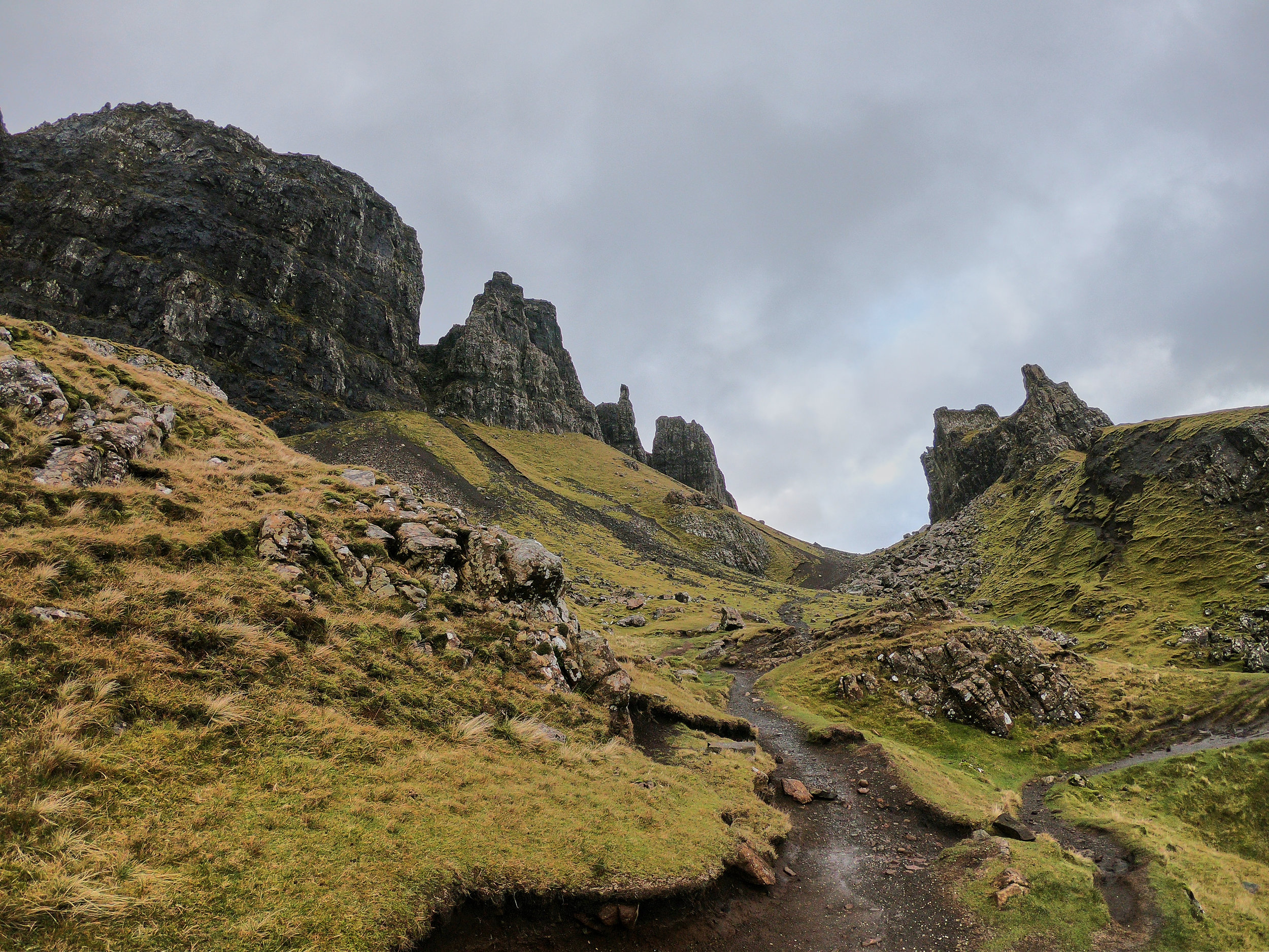
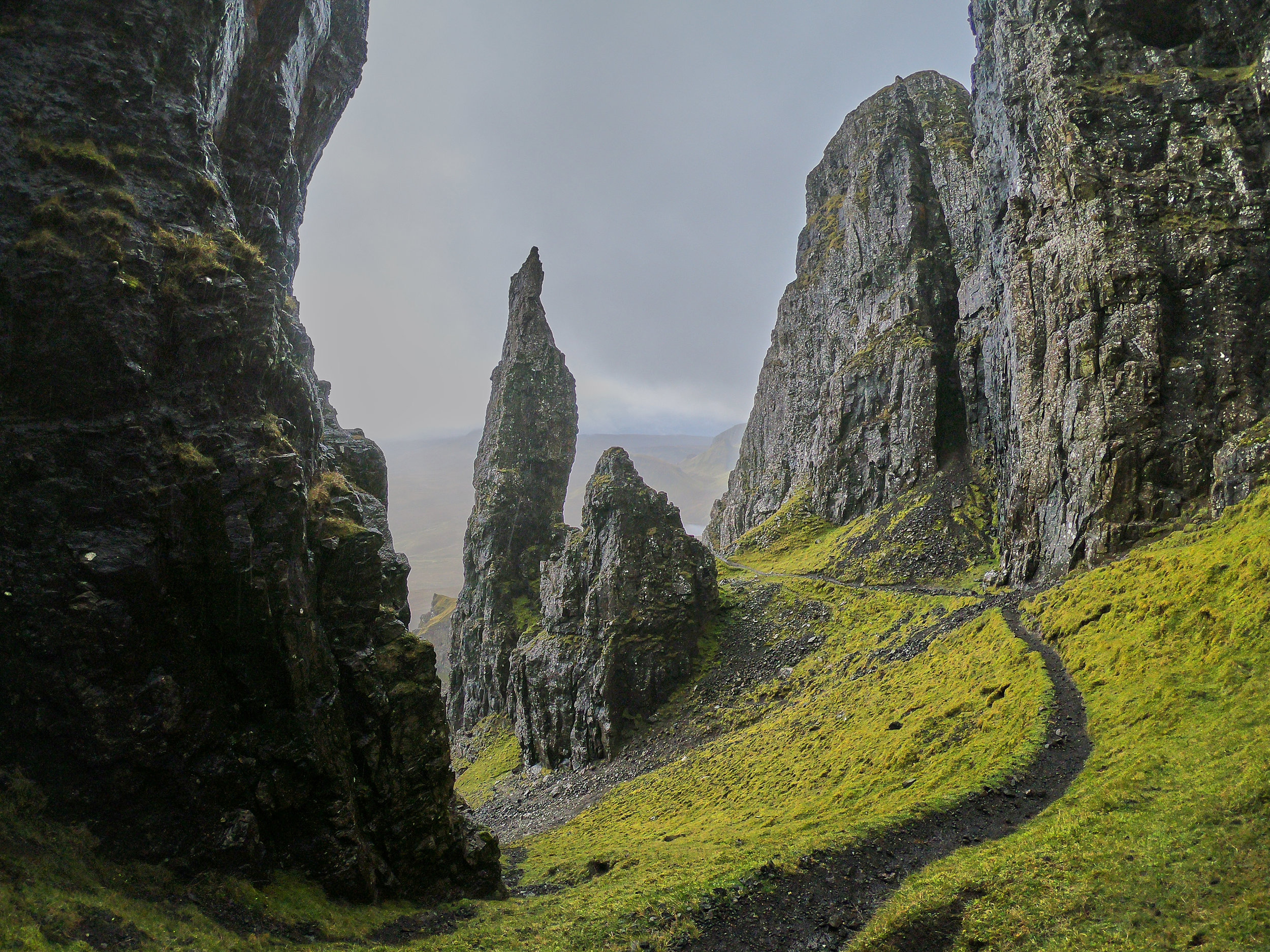
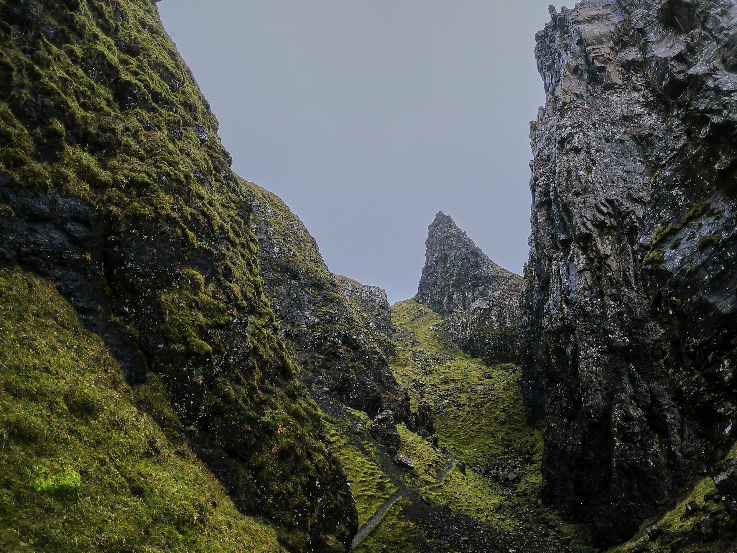
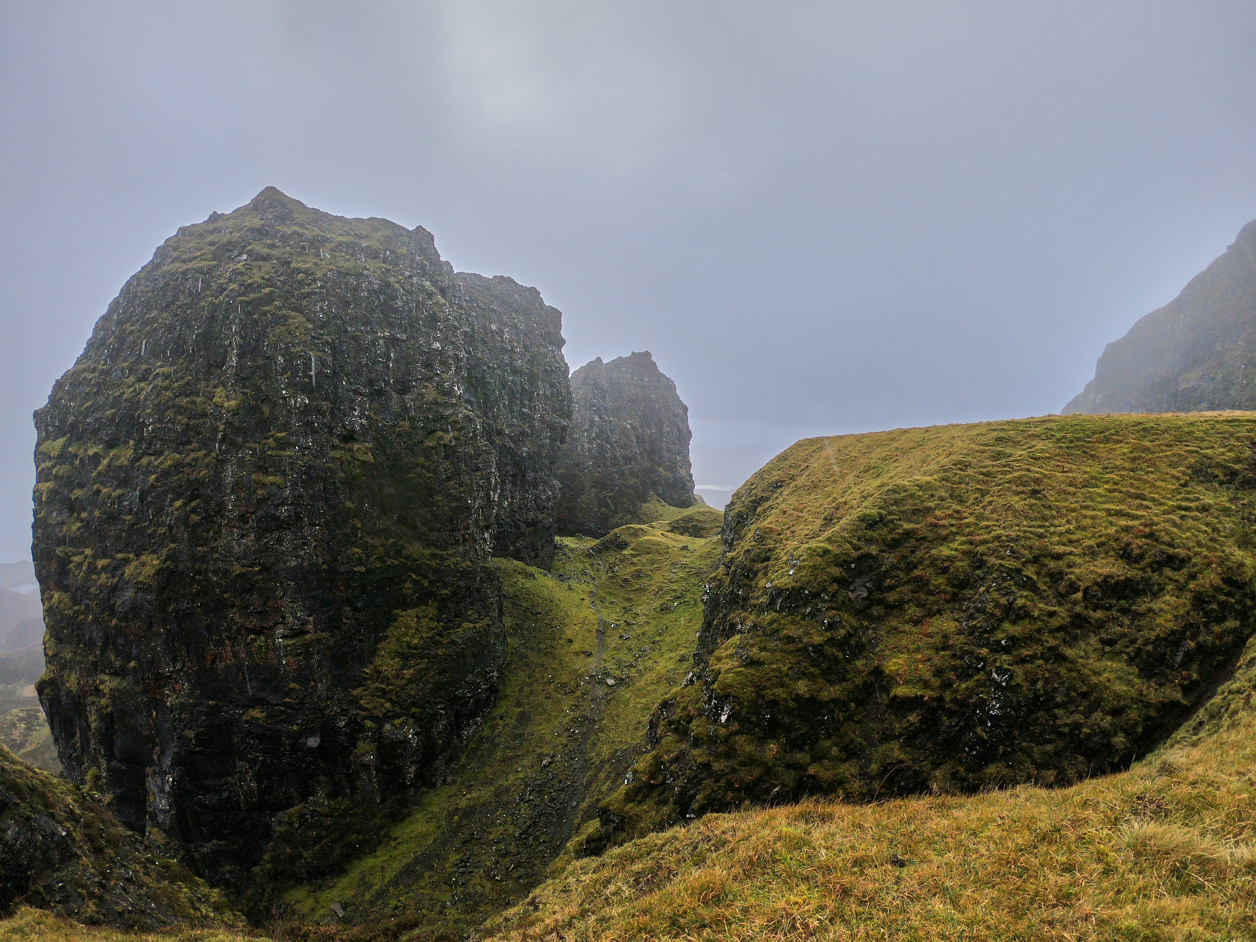
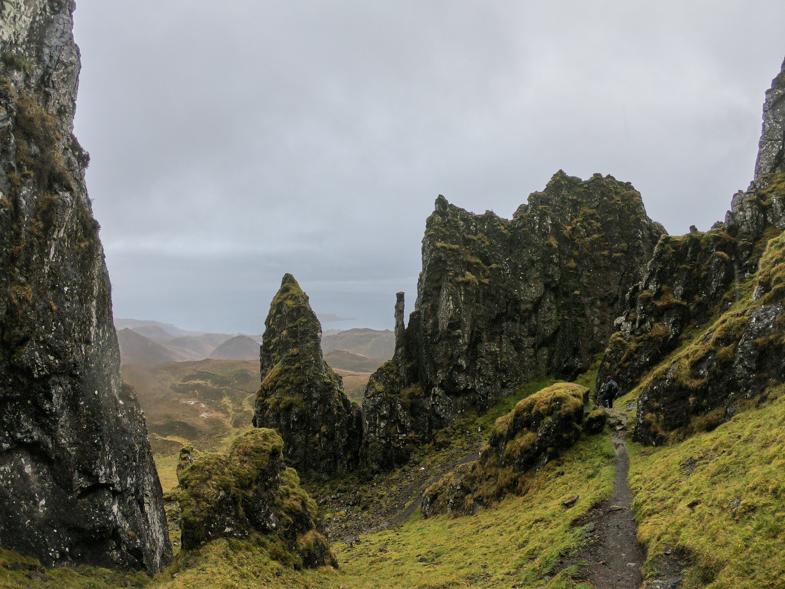
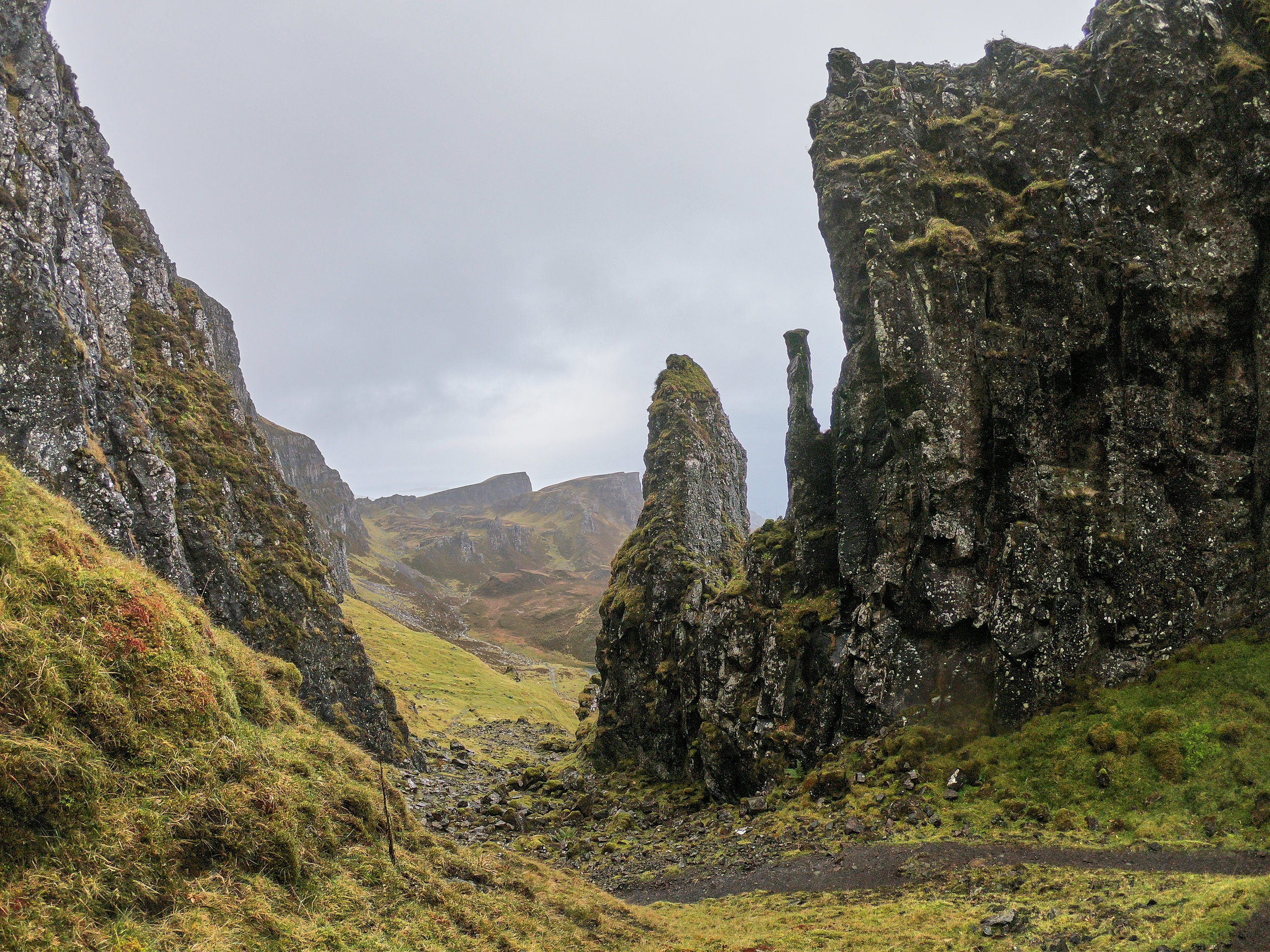
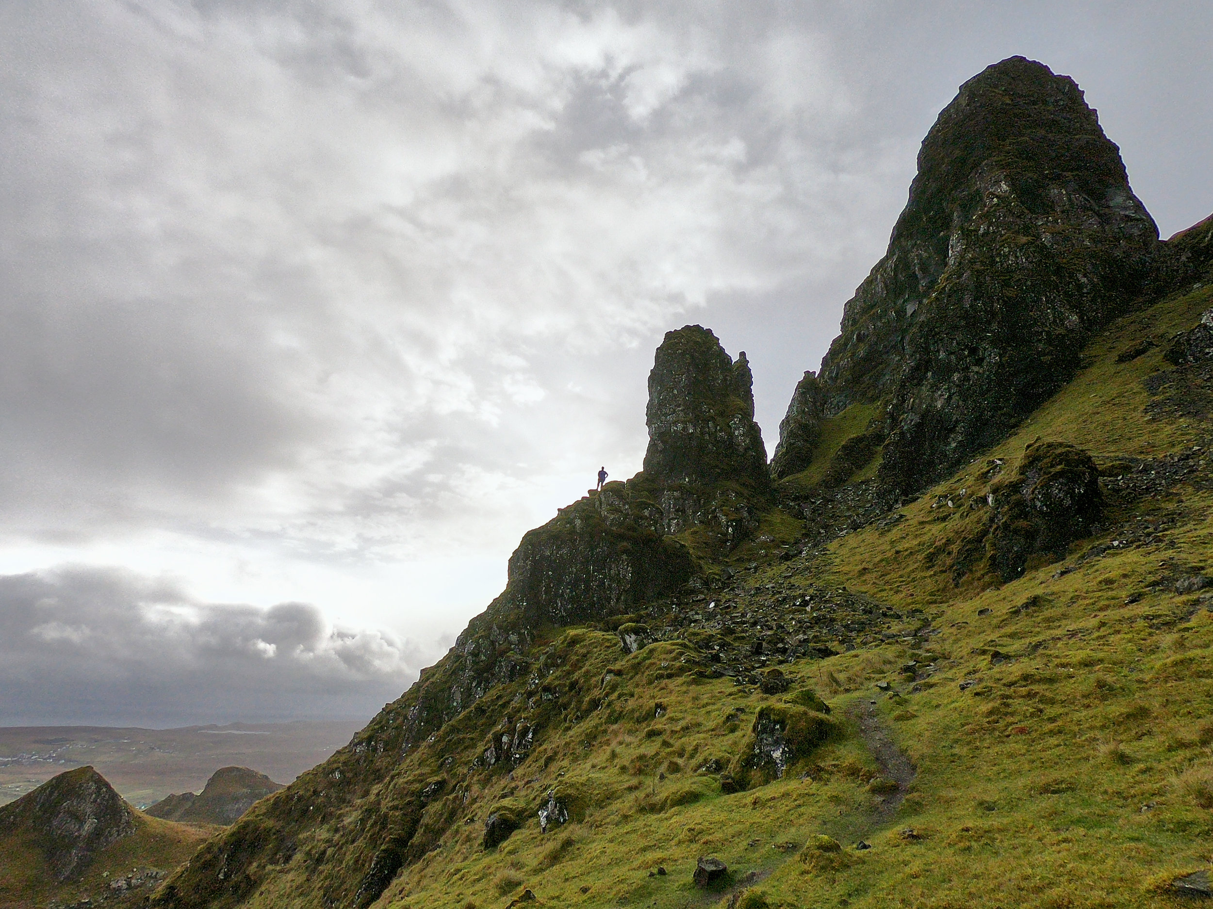
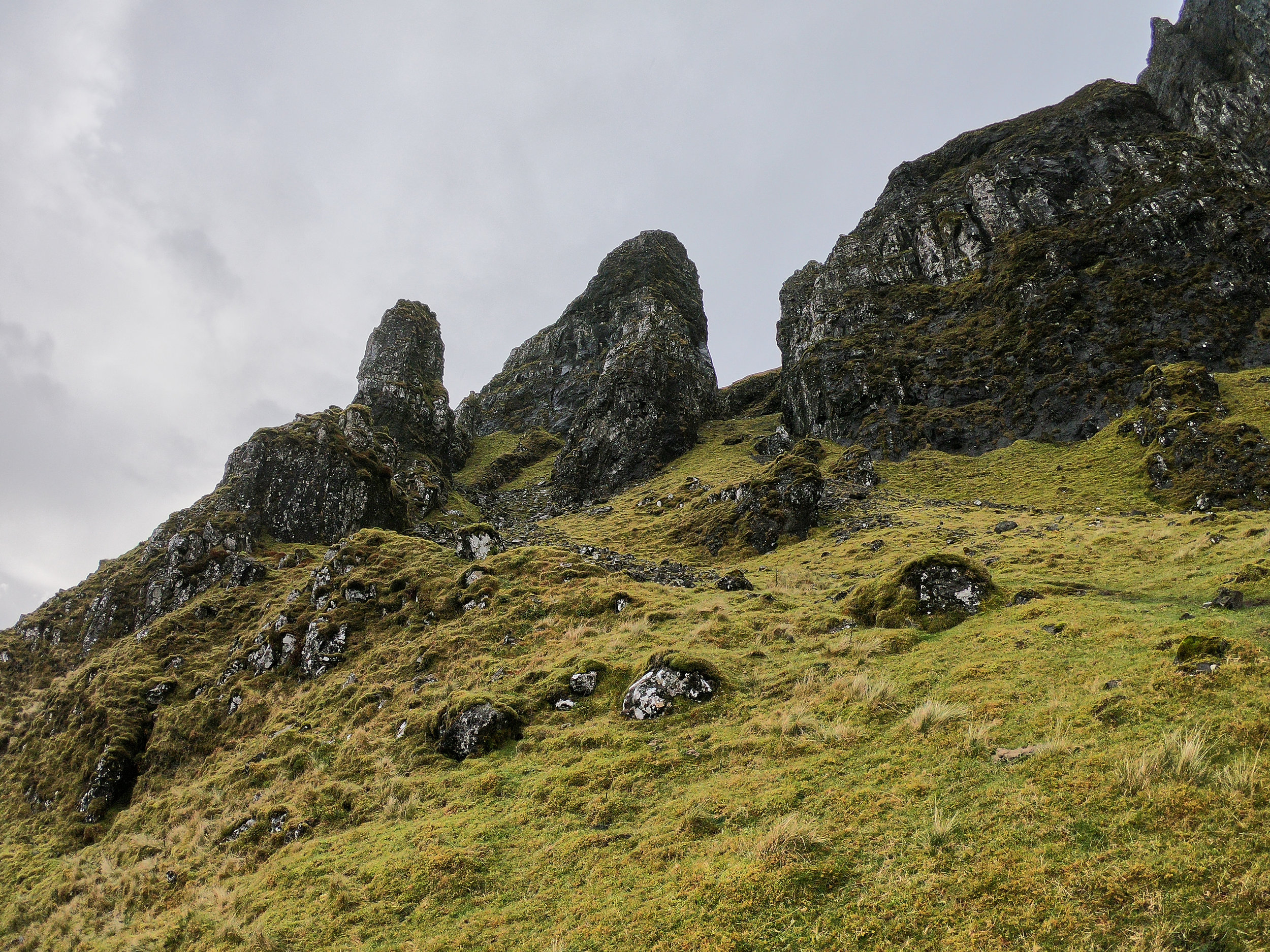
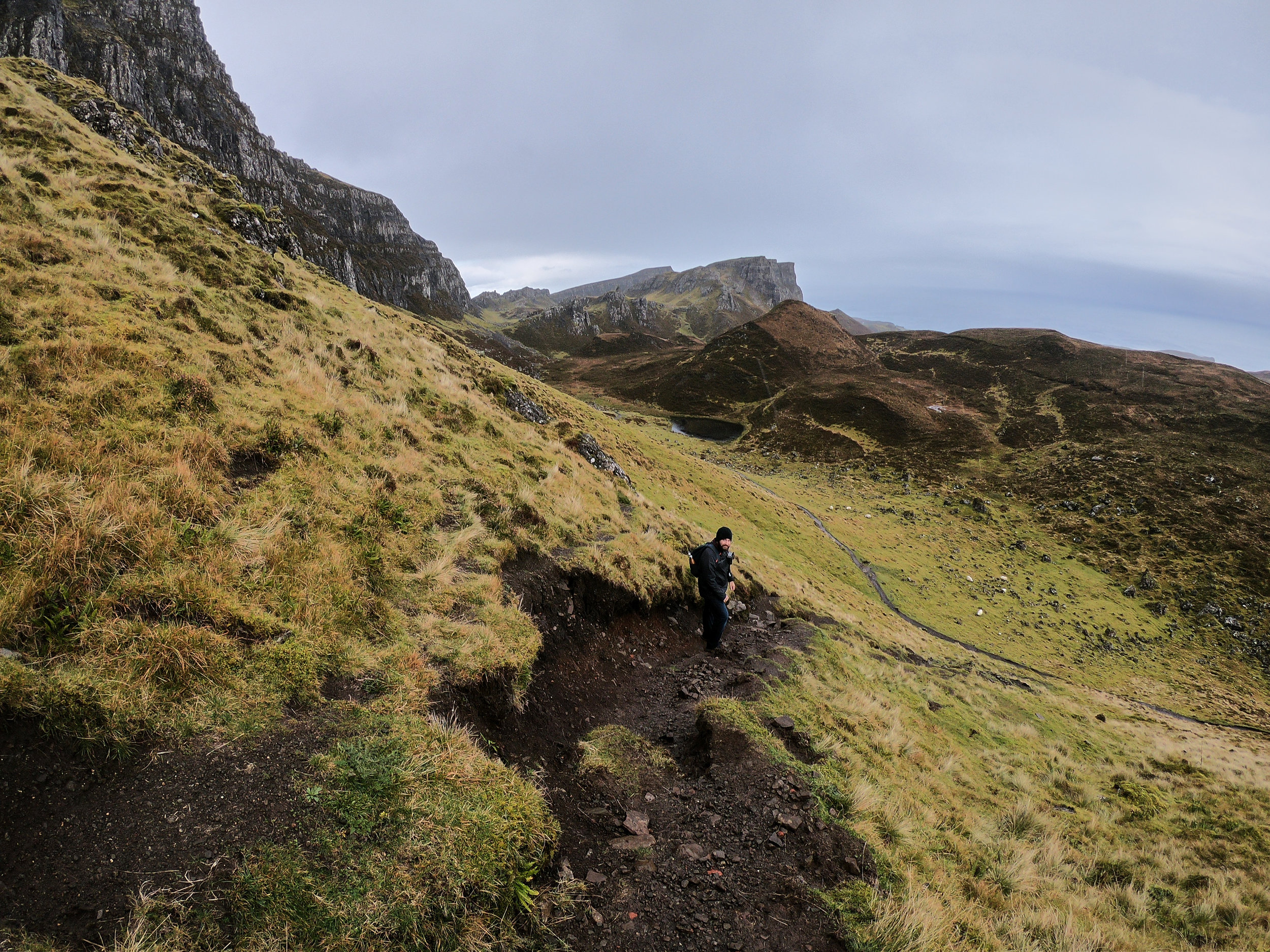
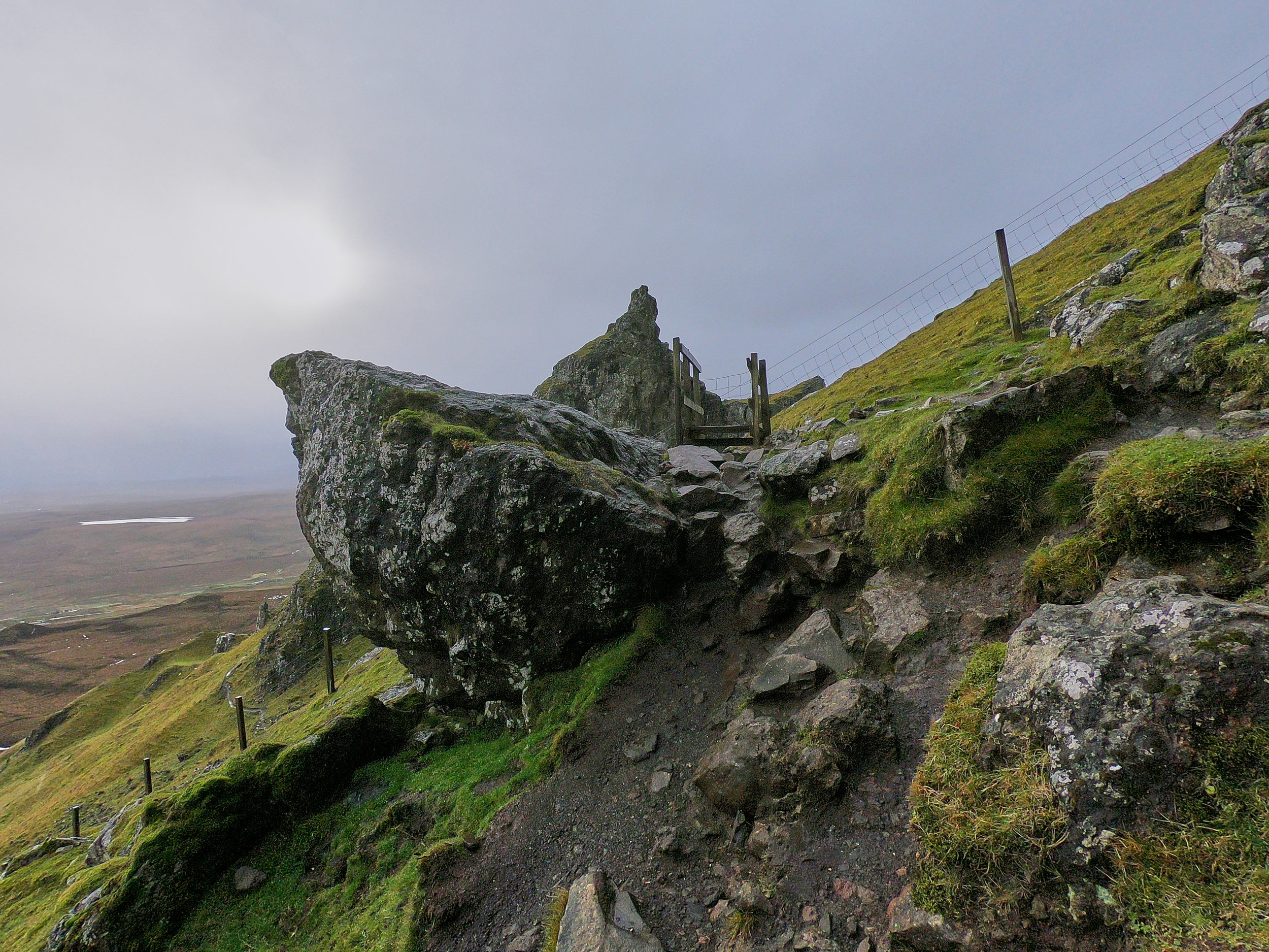
After a few more hundred more meters we made our way to start of the formations. To our right we could see one known as the Prison, and to the left at the top of a steep hill we could see the back of The Needle (different from The Needle near the Old Man of Storr…check out our post on that awesome hike here!). To get to the next section of the pathway requires a steep scramble up some loose rocks/muddy pathway. Again, for hikers and people who are frequent mountain walkers this part will not be difficult. However, if you are looking for a casual, easy stroll, you may want to turn around and head back to the car park at this point.
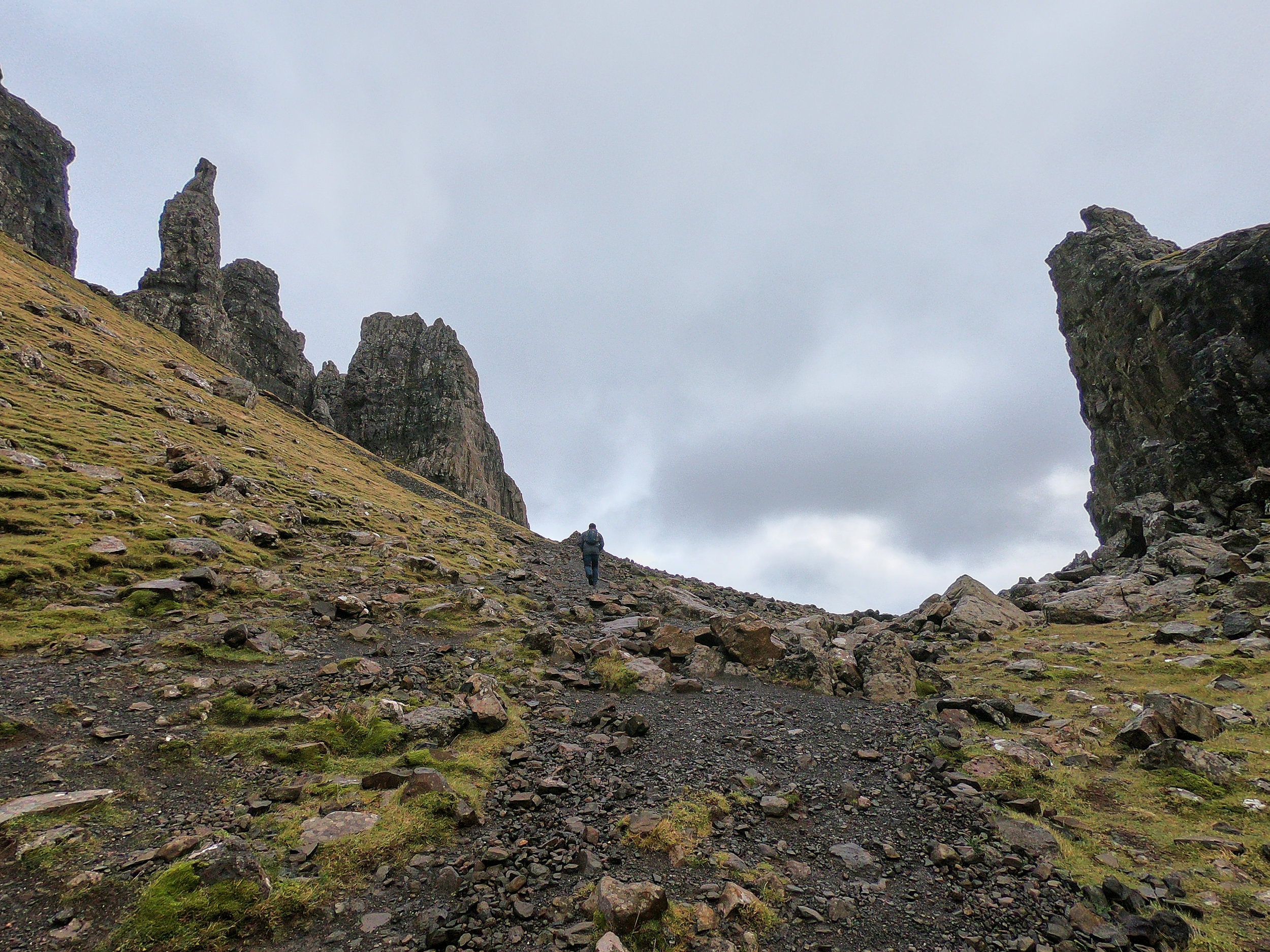
We headed up to the steep scramble part of the pathway. Darrell was still not feeling 100%, so we really had just planned to hike to this point and turn around. But he was doing great! The hike was not as challenging as we expected, and the weather was still really good, so we decided to keep going.

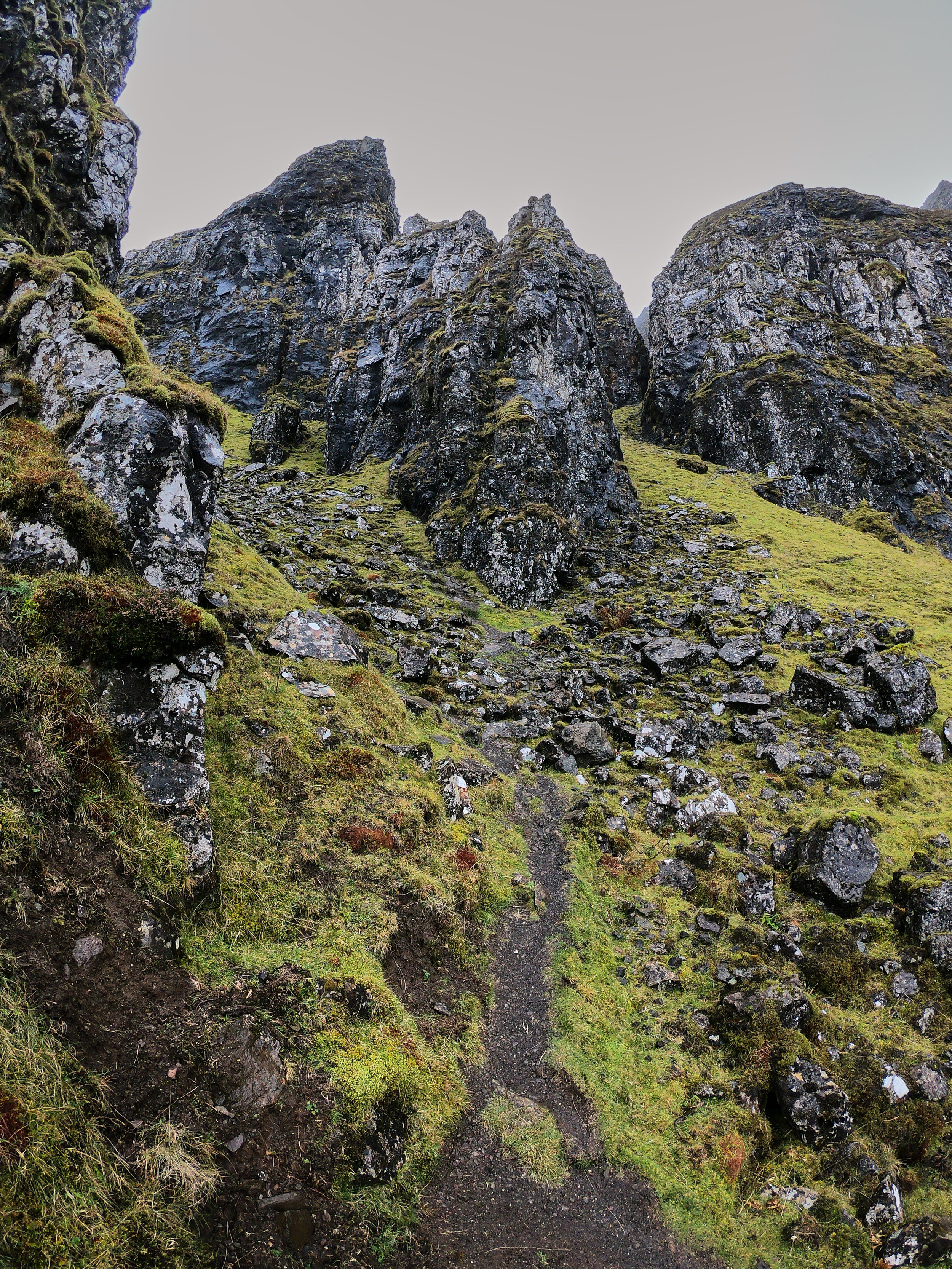
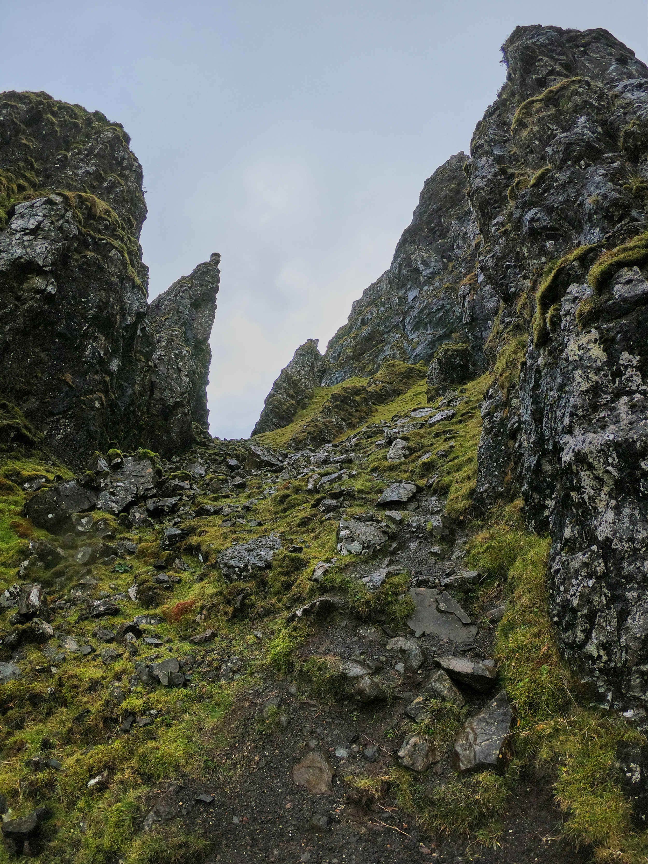
We were so in awe of the cool landscape and formations that we made a decision to head off the main path at this point. If you are standing on the main path and look to the left under The Needle, you can see a super steep pathway zigzagging to the base of The Needle. We decided to head up and get closer to the formation, so we started climbing up the steep path. It was crazy steep – we estimated it was at least a 60-degree angle, and most of the time we were crawling up! Halfway up we both thought that maybe it wasn’t the best idea, especially because going down would be really challenging. But we were too tempted and figured we were already halfway there, so we kept going.
We had finished about 4/5 of the climb when hail and sleet hit us. It was absolutely terrible! Within a matter of seconds we were totally drenched and fully exposed on the side of this steep climb. It was not ideal to say the least! We decided our best route was to continue to head up to the base and find some shelter while we make a plan to get back down. By now we were both pretty disappointed with our decision to climb off the main pathway. We knew there was a high chance of bad weather, and we likely shouldn’t have gone up. Fortunately Sharleen had cell service, so we were able to find another route down on our Maps.Me app. It didn’t take long for the hail and sleet to stop, and after about 5 minutes we were left with a light rain, making the conditions a little better for our situation.
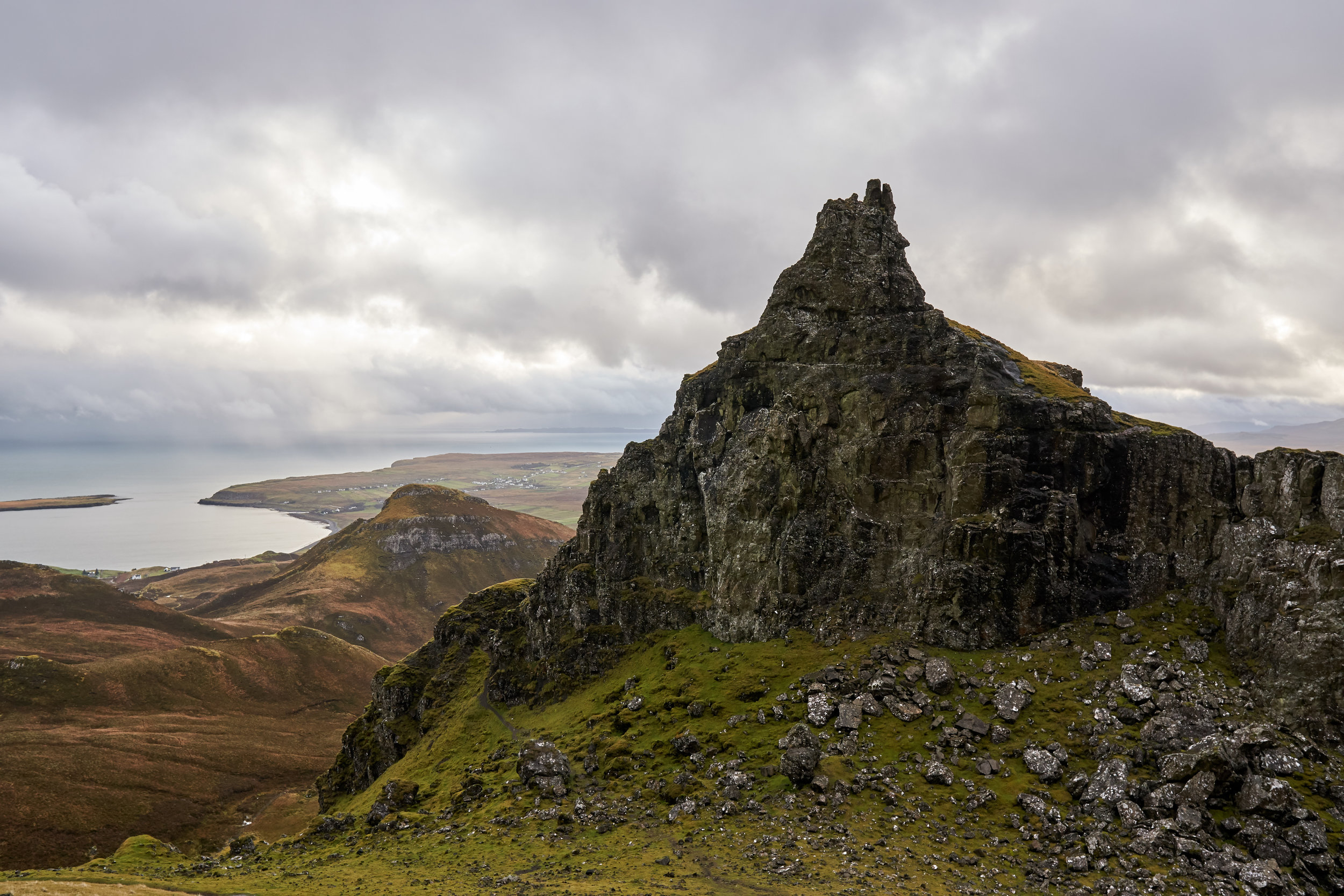
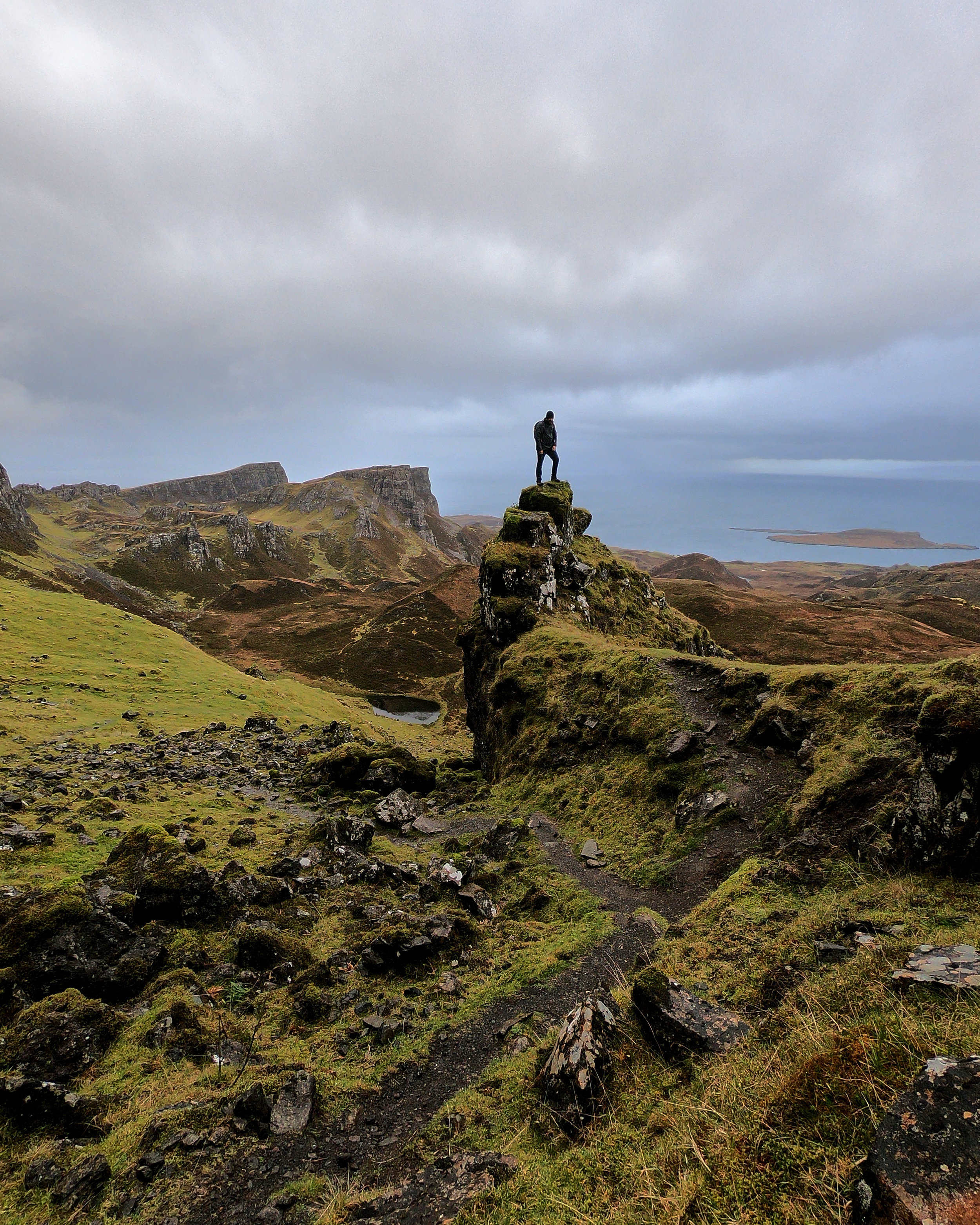
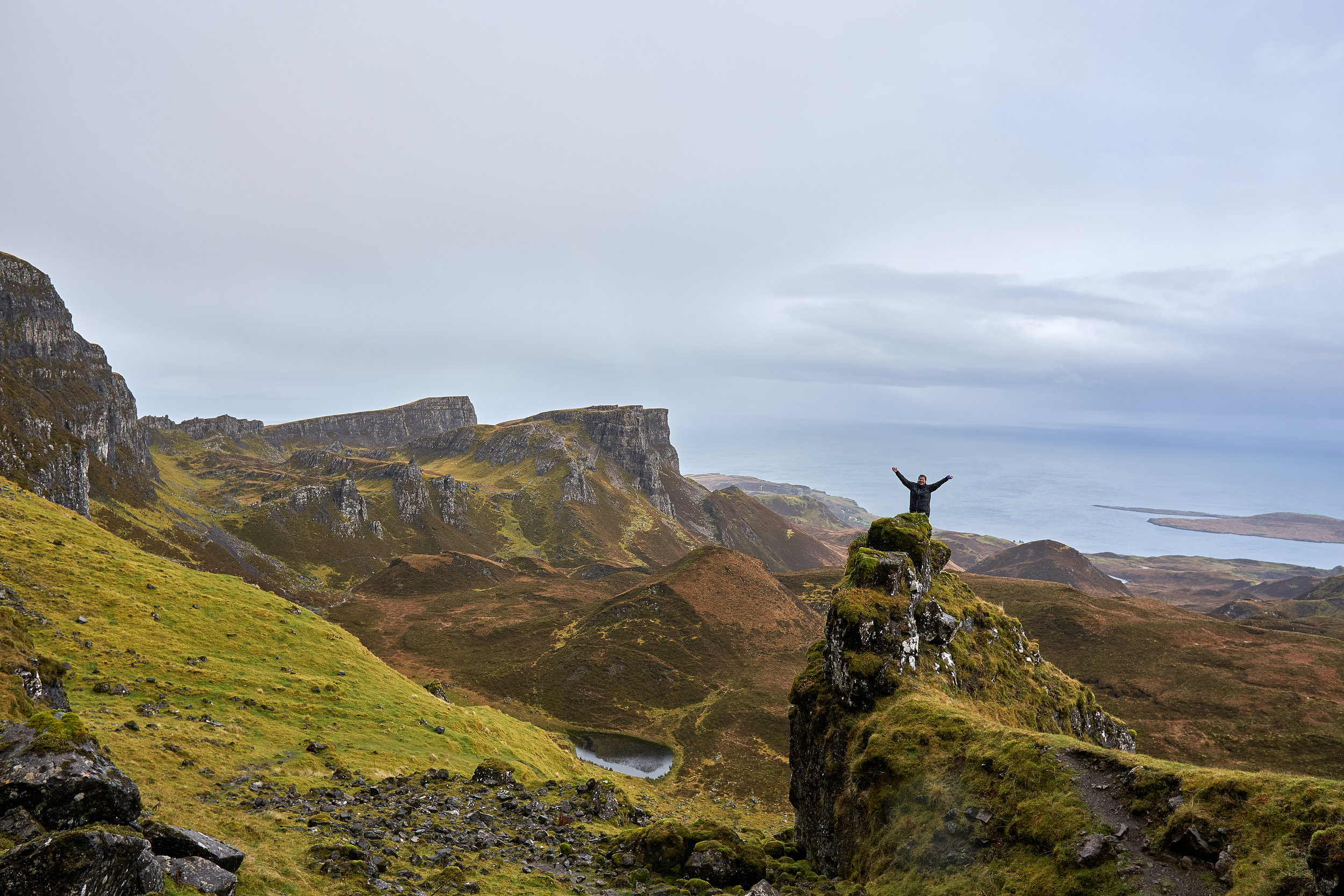
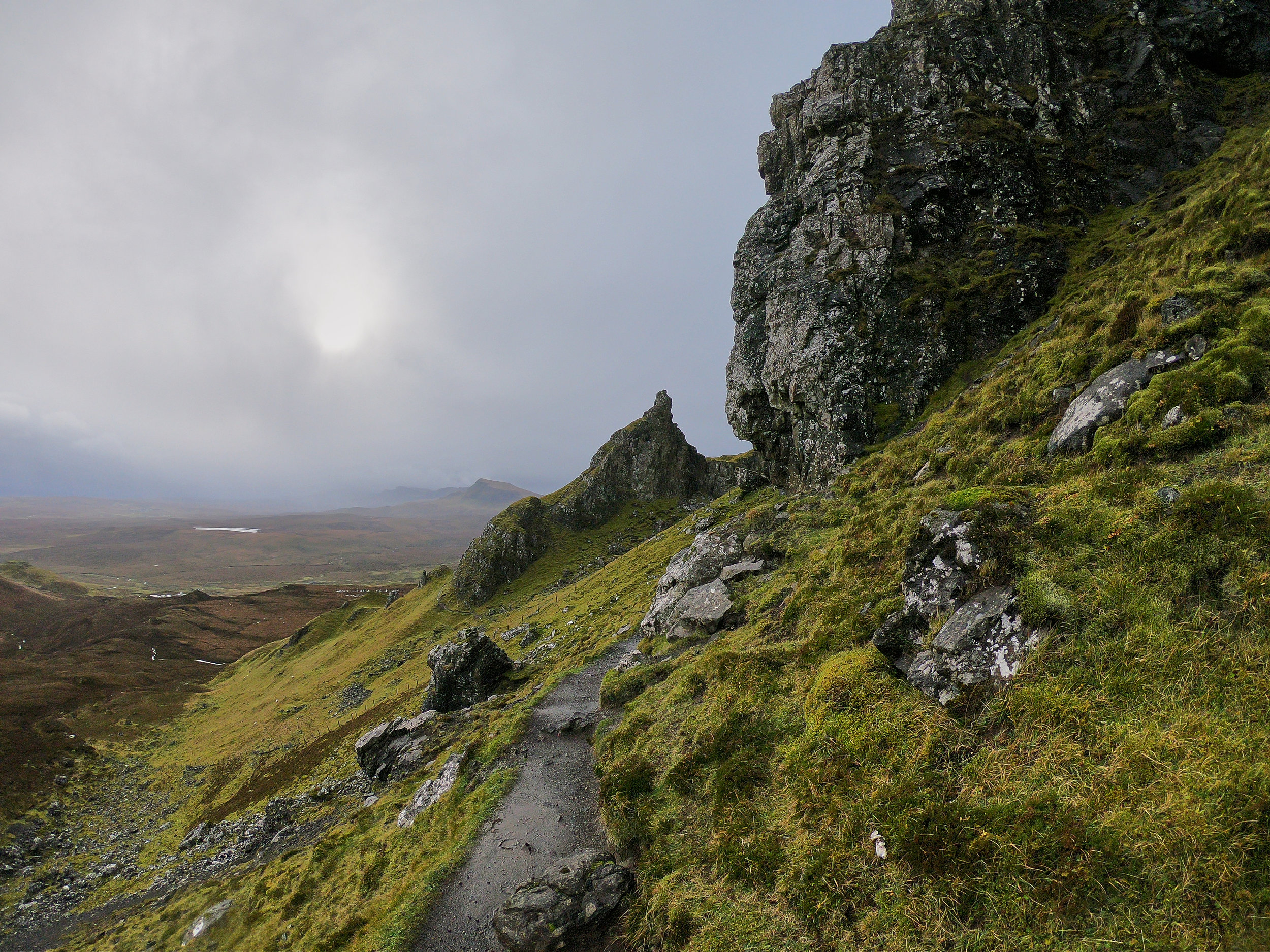
The views at the top were even more gorgeous! Especially with the rain, everything was wet and the colours really popped. We couldn’t use our main camera due to the weather, but we had our waterproof GoPro along so we were happy we could capture some cool pictures of all of the formations around us.
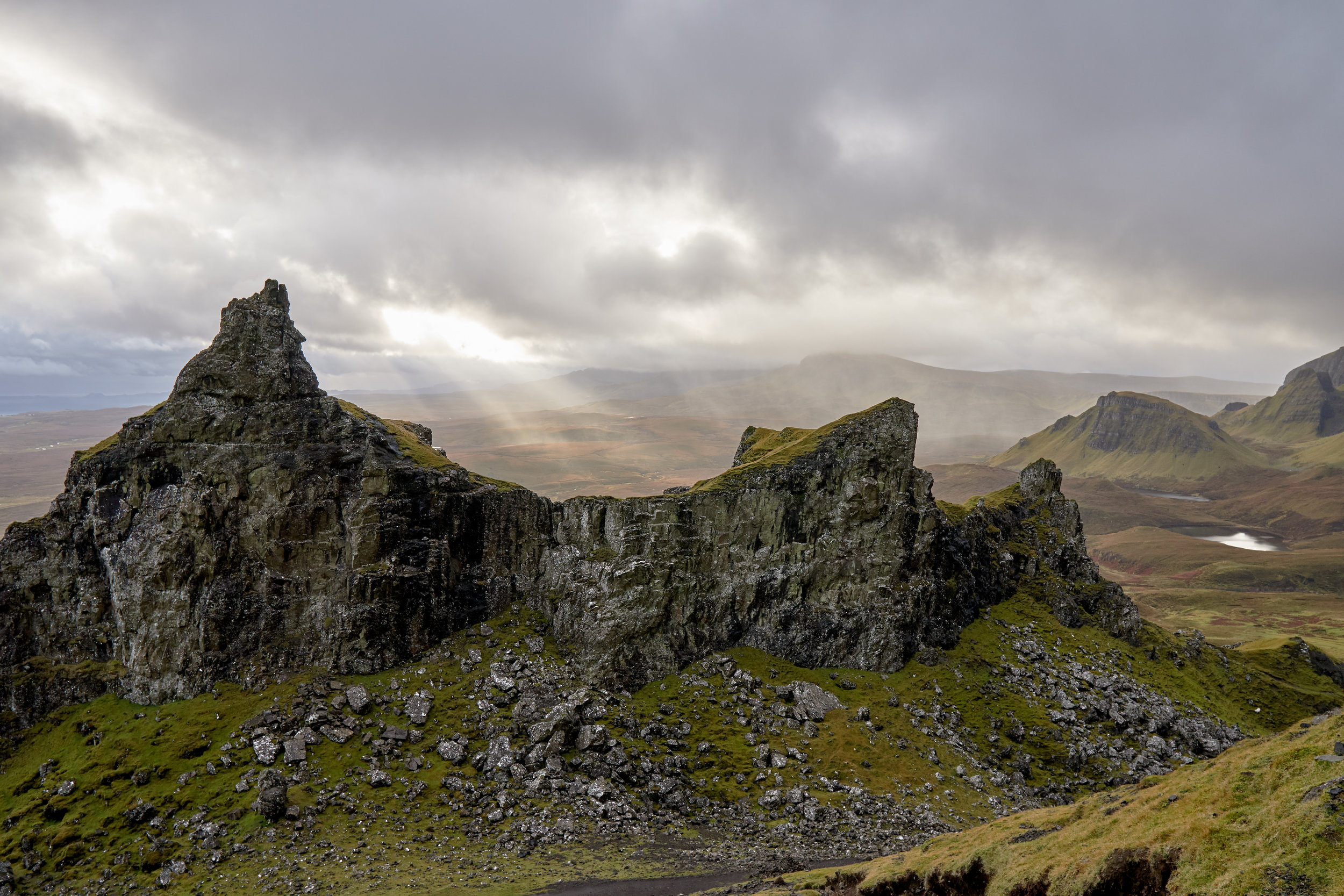
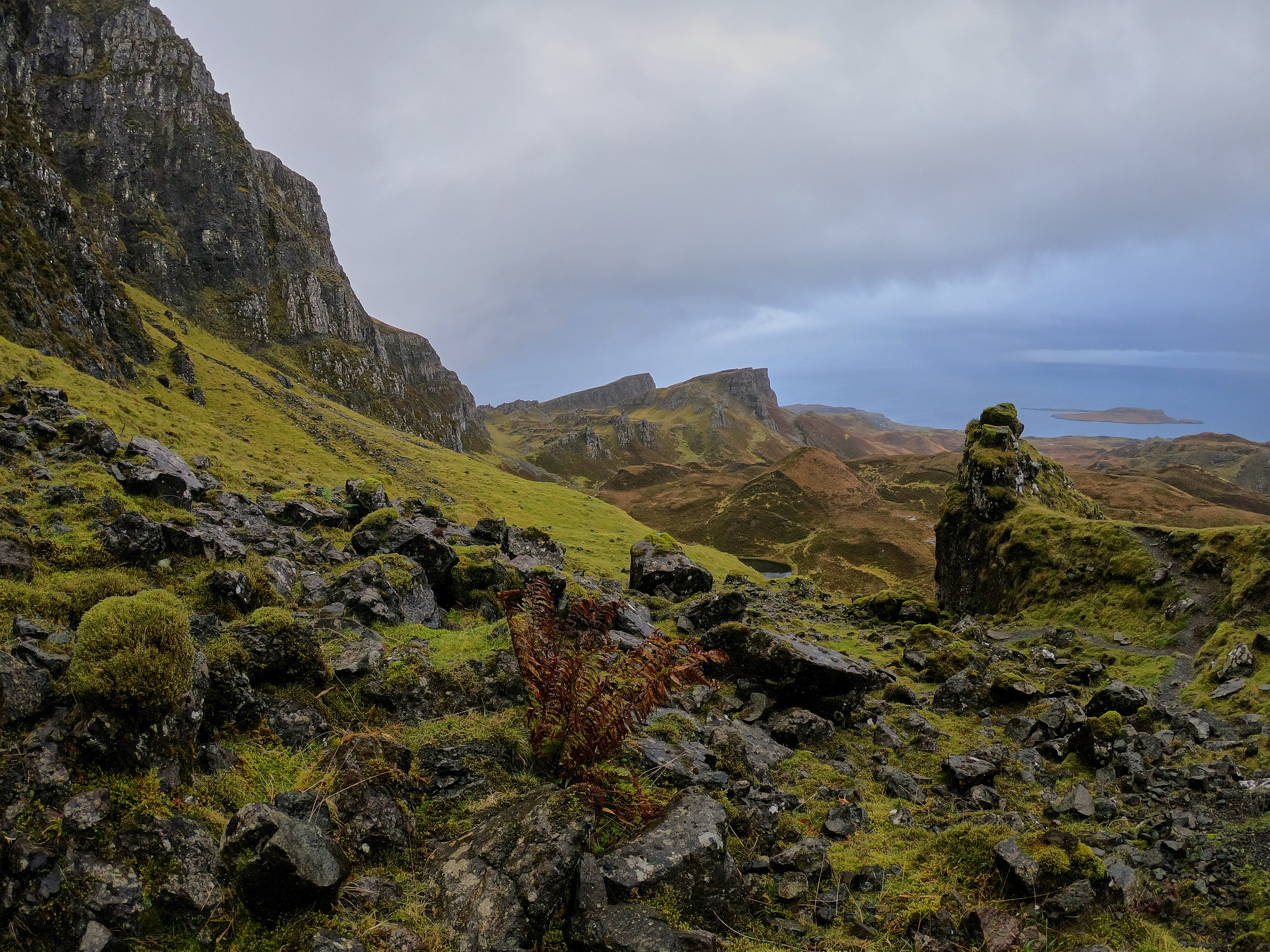
Our adventure back down took us through a maze of formations, until we came to another famous on in the area called The Table. It got its name because the top of the formation is large and completely flat, like table top that is the size of a football field! There was so much space on top and the views were great. Apparently locals use to hide cattle and sheep from Viking raiders on the flat top of The Table, since you could not see them when looking at the formations from below. We have no idea how they got them up there, considering how crazy our climb was!
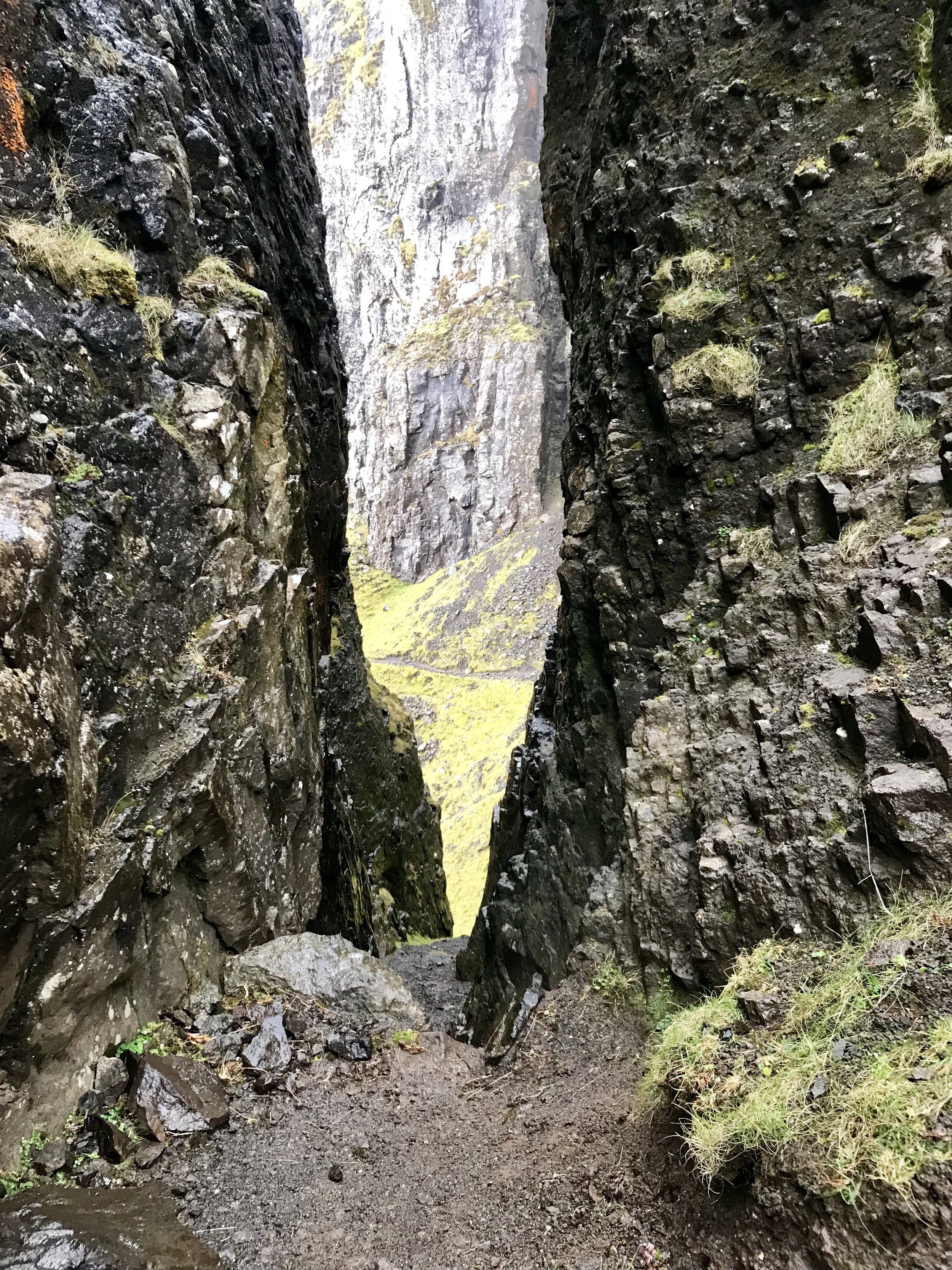
We headed down off the top of The Table through a narrow and steep crevice. The pictures above are from the top of The Table, and you can see the top of the crevice we climbed down in the picture to the left. It looked like our best option, as it was relatively sheltered and there were plenty of spots for our feet and hands as we made our way down. By this time the rain had stopped as well, which was awesome.
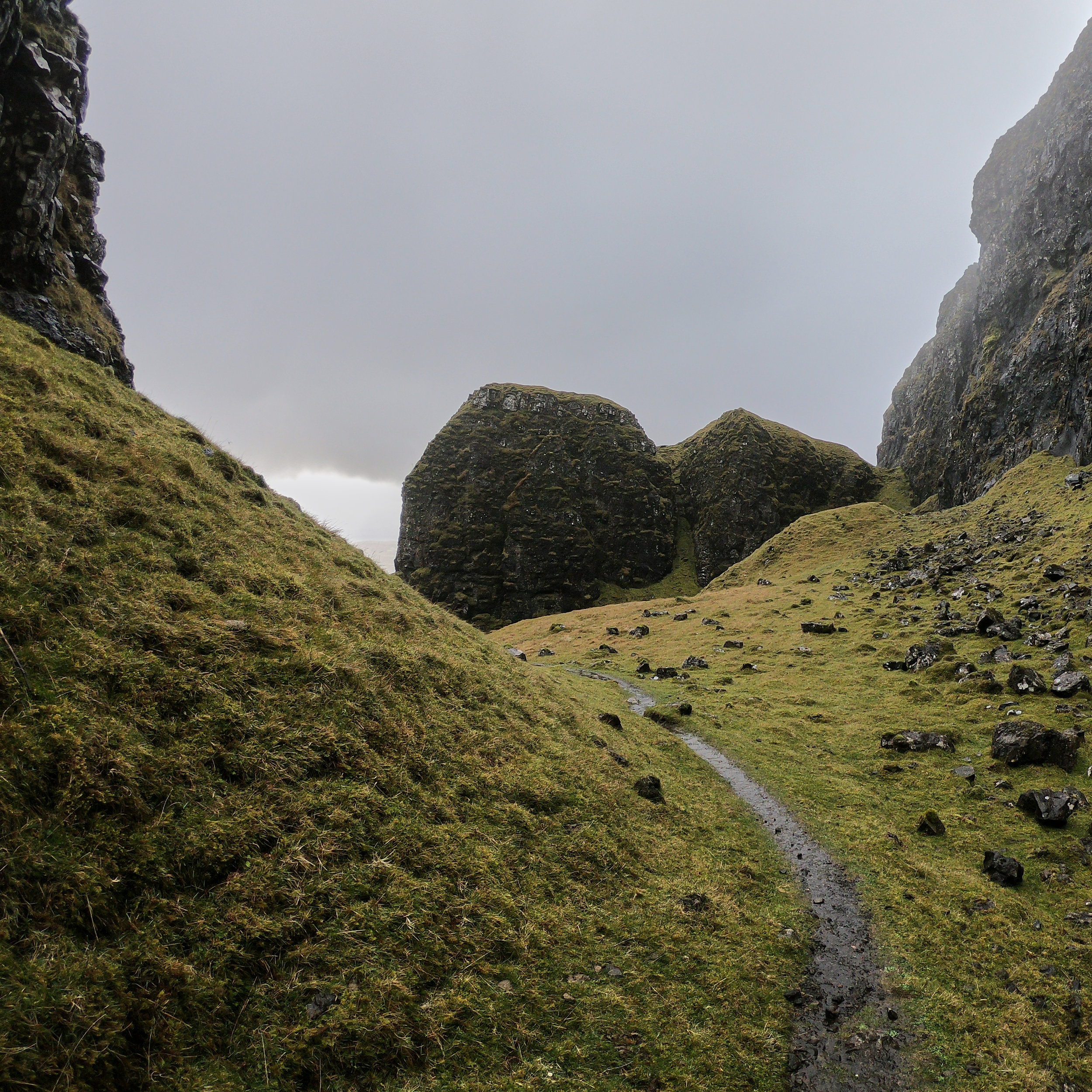
Once we were out of the crevice we were halfway down to the main path. The next section was through some more cool formations, and again we found ourselves in awe of our surroundings. Since the weather had improved and we could see our way down, we were in better spirits. We knew we would get to the main pathway safely, so we stopped here for a little while to snap some cool pictures of each other.
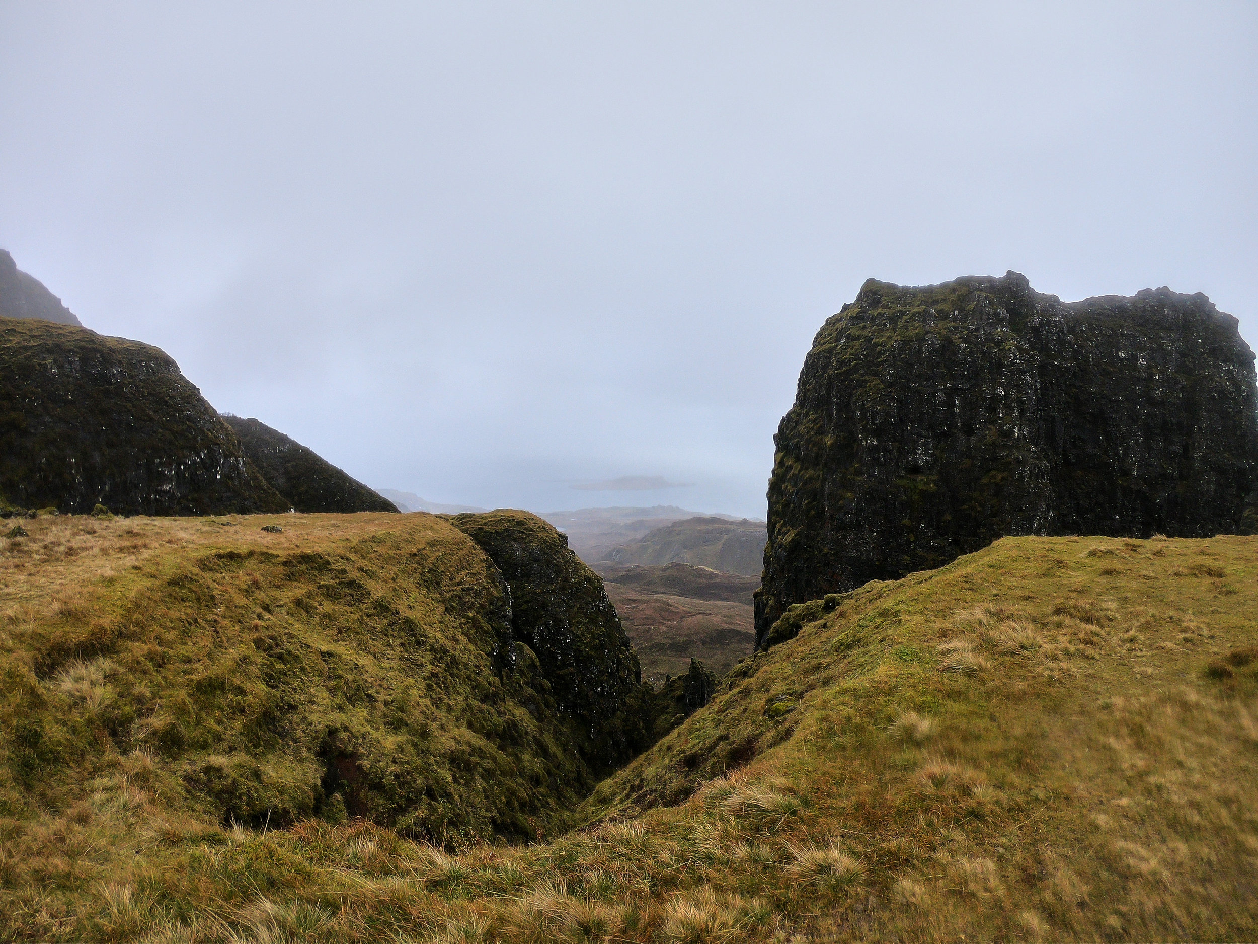
From here we headed down a steep pathway that joined the main path. We were happy to be safe and down on the main path again, but also happy we got to see the cool formations up close! From the main path we had two options, we could continue to head down the pathway, as it would lead to a more challenging hike that looped above the ridge and back to the car park, or we could head back to the car park in the direction we came.
We already had a fun adventure and were soaking wet, so we decided to head back to the car. It is also advised not to do the loop in poor weather since it is very windy on top of the ridge and most of the walk is near the ledge of the cliffs. So we didn’t want to take any more risks.
We headed back on the main pathway towards The Needle and the Prison formations. We had to cross a small sheep fence, but after a few hundred meters we were back to where we left the pathway to head on our detour.
The walk back did not take long, maybe 30 minutes or so. We were not stopping as often since it started to rain again and we were looking forward to getting to our warm car. On our walk back we passed close to 10 people who were heading on the hike. It looked like they were on a photography tour, as they were totally geared up. We were happy we went early and caught nice weather for at least half of our hike.
Overall we loved our hike to Quiraing! It’s been our favourite short hike, and would even rank it in our top 5 hikes so far this trip - you just can’t beat the views! It also offered a great mix of challenging and rewarding sections. The hike is great for all fitness levels, especially up to the base of the Prison. We estimated our hike to be just over 5.2km long, but without the detour it would have been closer to 4km (2km in and 2km out).

If you are looking to climb up to the base of The Needle like we did, or do the full loop, we would highly recommend that you only do so in good weather conditions and if you are comfortable with steep climbs and heights. As with all hikes and outdoor activities on Skye, it is important to check the weather and plan your outings on the best days. We had 7 days on the Isle, which meant we could be flexible with our schedule and see things in the best conditions. The weather here can be very harsh, and it’s not worth risking your safety to explore the sites, so make sure you plan ahead and leave time in your schedule to be flexible.
This was our second short hike on the Isle of Skye. Click here to read our blog post on the Old Man of Storr, and stay tuned for our next post on Brothers’ Point!


